Colorado Trail Day 5. Sunday, August 3, 2025.
The sky was clear last night, and at an altitude of almost 10,000 feet, that means low nighttime temperatures. At 6 a.m., it was only 2 degrees C, 36 degrees Fahrenheit. Of course, there was condensation in the tent, but it didn’t bother us.
I was too tired to write last night, so I started with it when I woke up at 5 a.m. I let Inger sleep until I finished writing at 6 a.m. I had to wait to publish on Facebook until we got higher up. We generally only have cell phone coverage at higher elevations.
The sun had reached the valley floor when we started our hike at 7 a.m. The cold morning meant we were wearing a lot of layers, but they came off after a few kilometers.

The CT is divided into a total of 28 segments, based on where it’s possible to «connect to» the trail from a road. Today is Sunday, and there are many day hikers and weekend hikers who are walking segments of the CT. We can tell the difference between these hikers: day hikers have small packs. Weekend hikers have large packs, even larger than ours, who are hiking the whole CT. They aren’t as conscious of weight and like to bring a little luxury with them.

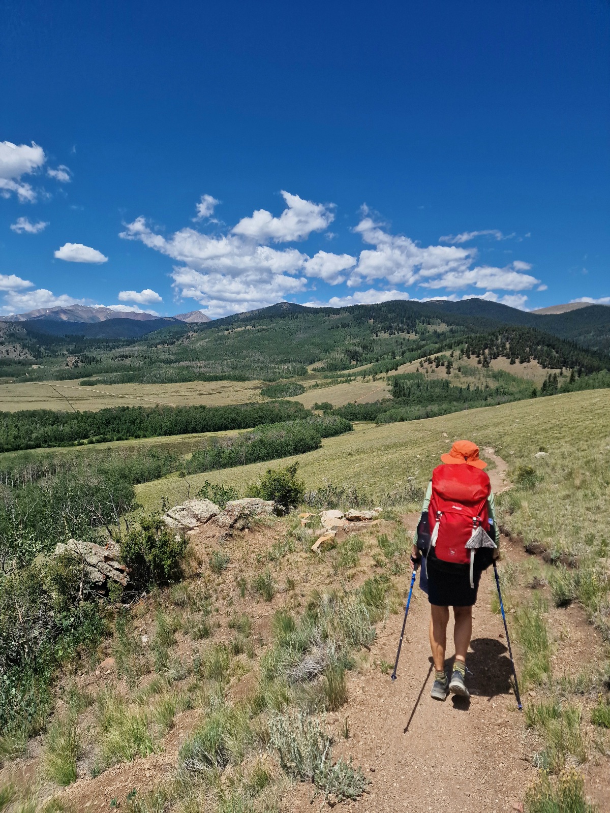
We started in the middle of Segment 5 today. The landscape has changed since we started the trip. Today, we hiked in several open areas that offered great views. The trees have also changed. Today, we hiked through sections with aspens. There were also sections with five-needle conifers.


At the end of Segment 5, after about 12 km, we arrived at Kenosha Pass, where US Highway 285 passes. There is also a trailhead and a campground there. Since it’s the weekend, we hoped there would be «trail magic.» It’s usually on the weekends that trail magic happens.
There was no trail magic, and we have to admit we were a little disappointed, even though we had no reason to be.
We had tortilla wraps with peanut butter and chocolate. We don’t like plain peanut butter, but in Denver, we found a jar with a mix of peanut and chocolate. It tasted much better. We usually eat Nutella.
After we ate, we went to cross the highway. The traffic was very heavy, and we stood with Beatnick, waiting for a gap in the traffic so we could run across. It felt like forever.

On the other side of the highway, there was also a campground. A camper was there, where Dan lived. He was 49 years old and a former hiker, but a bad knee was now preventing him from hiking. He was excited about tomorrow morning because he was going to the hospital to get a new knee.
Dan had trail magic at his camper. We got cold soda, fruit, some snacks, and muffins. He also offered us the chance to charge our electronics. And there were chairs to sit in. We miss being able to sit with back support. We have lightweight, 500g Helinox chairs at home, but we didn’t prioritize them for this trip. It was really nice to be there with Beatnick, Dan, and Marissa, who also showed up.

There’s a limit to how long we could sit there, even though Dan also offered us beer. We politely declined because we had to continue on the trail.
The trail went through a beautiful landscape, and we got excellent views. In the direction of our hike, we saw high mountains that we’ll be crossing tomorrow.
Today’s goal was Jefferson Creek. The creek is at the start of the 600-meter climb up to the highest point at Georgia Pass. You should go over the 3620-meter summit early in the day, before the daily thunderstorms start.

Today, however, for the first time, there was no thunderstorm. I hope the same happens tomorrow, even though Inger thinks it will be extra powerful tomorrow.
By the creek, there are several nice tent sites. We arrived at 2 p.m. and had a calm and relaxing afternoon where we could also wash our clothes and do a little body wash.
More hikers eventually arrived, and I observed 7 tents when we called it a night.
Today’s stage was 22 km and 750 meters of elevation gain. We are camping at 3050 meters above sea level.