Colorado Trail Day 9. Thursday, August 7, 2025.
I thought we had camped on the outskirts of the ski area at Copper Mountain, but as we started hiking, we passed several ski runs and lifts.
The trail climbed from the start, and as we left the resort area, we entered a small valley where Guller Creek flowed. We followed the right side of the valley, a steady, gentle climb. The valley was forested with fir trees, but there were also many open sections that made for a beautiful hike. From time to time, we could see the treeless slopes above the tree line at the far end of the valley.


After hiking 6 km (3.7 miles) in the valley, we climbed above the tree line and the trail led up to Searle Pass at 3,672 meters (12,047 feet). Even though our bodies are starting to get used to the altitude, the thin air still makes us breathe faster on the climbs.
It was a perfect spot to take a food break on the pass, where we had a great view. For the first time on our trip, we saw marmots as we were hiking up to the pass. They usually stay above the tree line and often stand still like statues, but their whistling gives them away. You often hear them before you see them.
On the way down from Searle Pass and up to Elk Ridge at 3,743 meters (12,280 feet), we saw even more marmots.


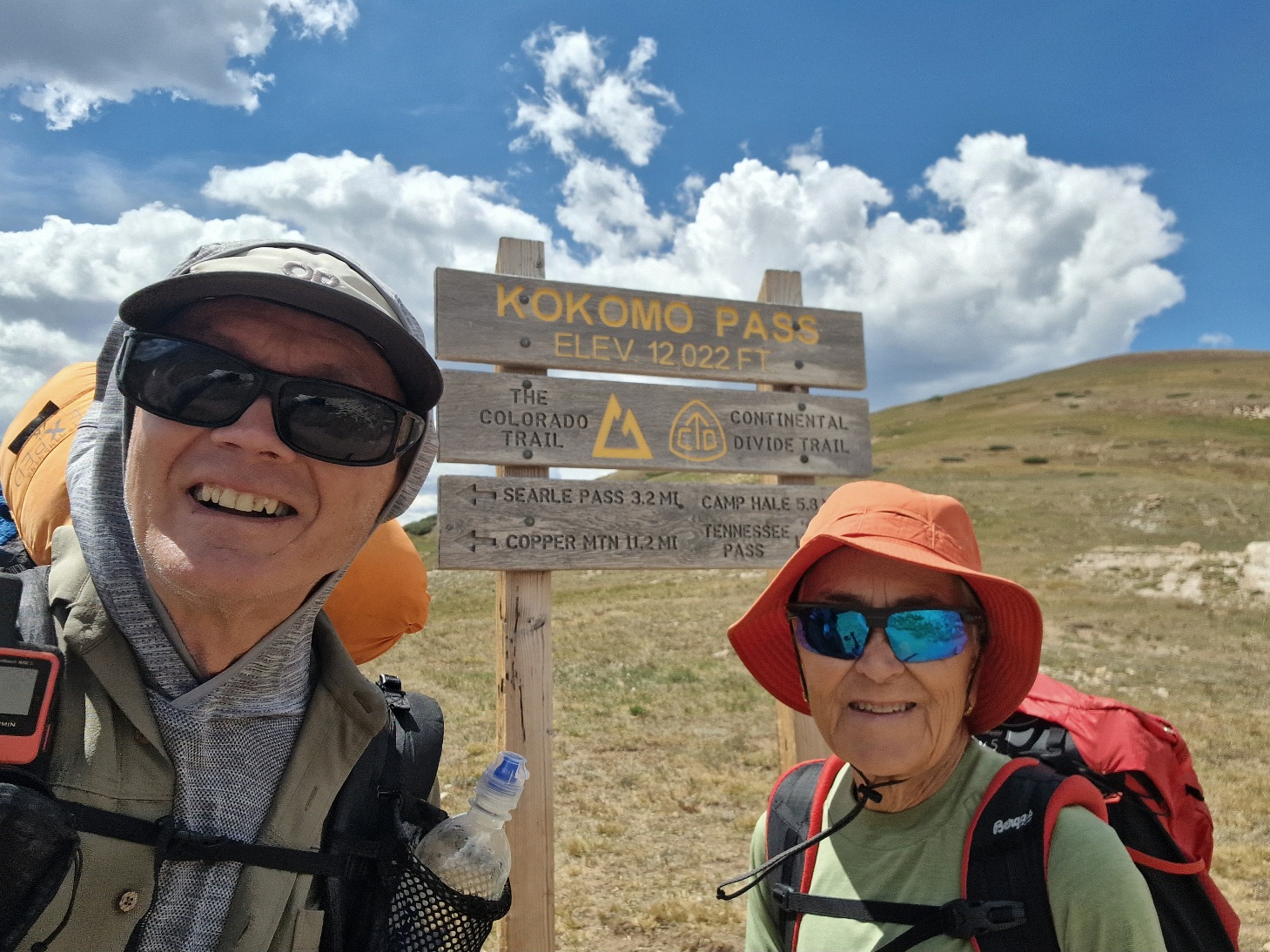
From Elk Ridge, the trail went to Kokomo Pass at 3,666 meters (12,028 feet). We had planned to take a long break there, but it was incredibly windy, so we continued down into the valley on the other side of the pass and had to go all the way into the forest to find shelter. We lay down on the ground in the shade of a fir tree and relaxed for a good hour before continuing downhill.


While we were there, Merilla and Chuck passed us. We passed them again when they took a break just below us.
After 23 km (14.3 miles), we reached the bottom of a larger valley. It was completely still there, and the hiking became hot with a temperature of 27°C (81°F).


A few kilometers later, we started looking for a campsite. We crossed a small river and washed our feet—the trail was very dusty today. I filled my water bottles, so I had five liters in my pack; it was going to be a dry camp tonight.
After crossing the river, the trail started climbing. It took a while before we found a suitable campsite. The ground was covered with fine, black dust—ash from a forest fire. After 30 km (18.6 miles), we finally found a good spot.
I must have gone a little too fast on the final climb to find a campsite, because I was completely exhausted. In addition to the five liters of water, I was also carrying some heavy items from Inger’s pack, including her sleeping bag.
After dinner, I lay down and fell asleep immediately, before it even got dark. I couldn’t even think about writing.
Today’s hike was 30 km (18.6 miles) with 1,090 meters (3,576 feet) of elevation gain. We’re camping at 3,020 meters (9,908 feet) above sea level.