GR131 Canary Islands, Day 5: Saturday, Jan 17, 2026
Yesterday afternoon, we took the ferry from Lanzarote to Corralejo on Fuerteventura. Our plan is to spend six days crossing this island. The small towns we pass through have very limited lodging, so we are relying on tenting—even though it’s technically not permitted. The trick is to find a good, secluded spot tucked away among the lava rocks.
In Spain, they often use different gas canisters than the ones international hikers are used to. Finding a canister with a standard screw-top valve in the shops here isn’t easy; we couldn’t find a single one on Lanzarote. Luckily, we found a hardware store here that had one in stock. Unfortunately, it was twice the size of what we usually carry, but we bought it anyway despite the extra weight. At least now we can cook dinner at the tent.
We spent the night in an apartment in downtown Corralejo and were on the trail before 9:00 AM. It was clear skies and 15°C (59°F) when we started, but the forecast predicted clouds and rain later in the day.

Like Lanzarote, Fuerteventura is volcanic. However, geologically speaking, Fuerteventura is the oldest of the Canary Islands, and its volcanic mountains show significantly more erosion from over thousands of years. The most recent eruptions occurred between 4,000 and 5,000 years ago, and the trail actually takes us right past them today.
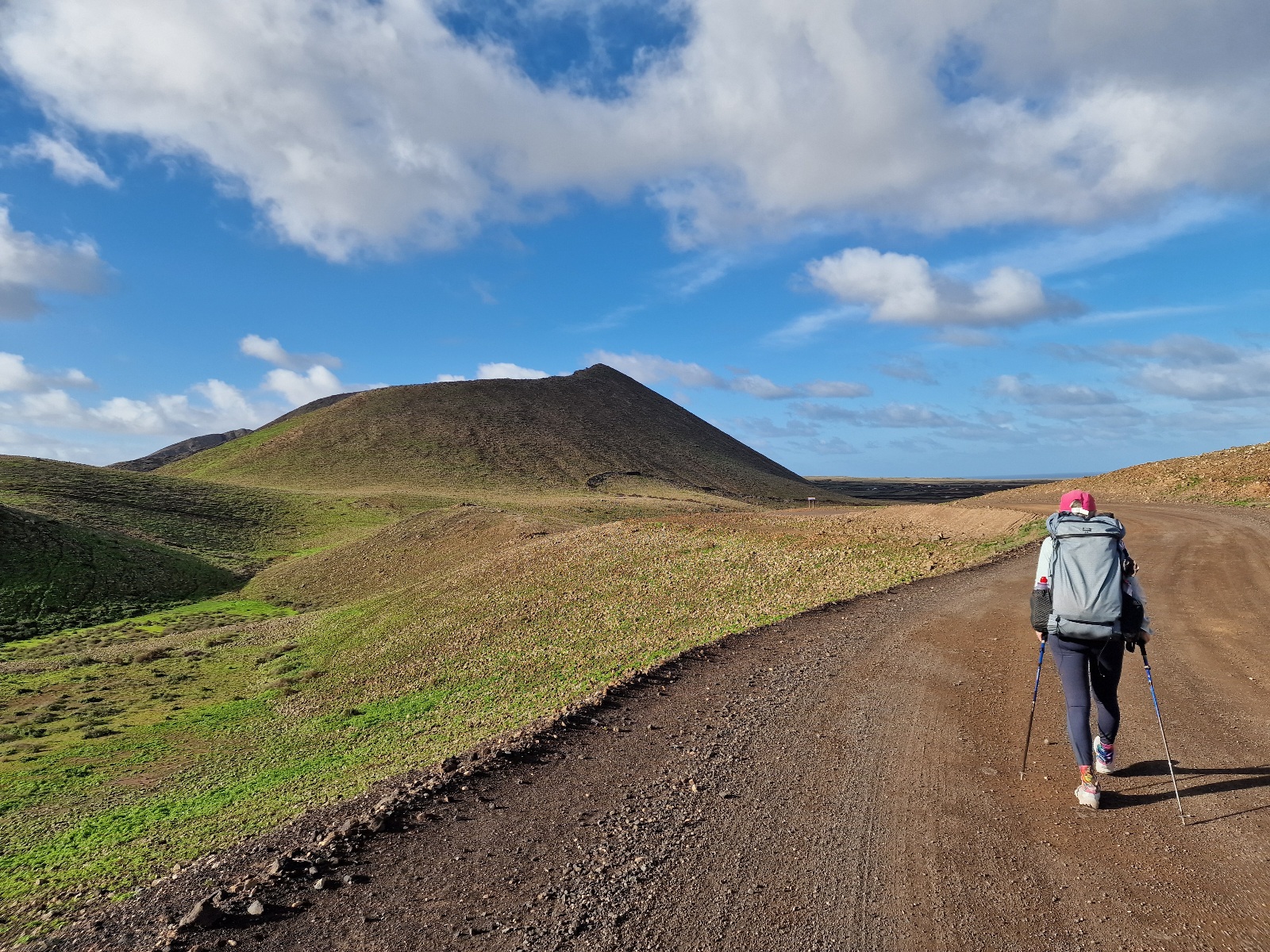
On the outskirts of town, the GR131 followed a gravel road that wound its way to the right of a series of the island’s youngest volcanoes. After about 8 km (5 miles), we reached the last two in the chain: Calderon Hondo and Montaña Colorada. The GR131 curves to the left of these two, but I wanted to summit a volcano, so we detoured from the main trail to climb them.
There was a clear path up to Calderon Hondo, and my map showed a trail continuing to Montaña Colorada.


As it turned out, the path only led to the rim of the Calderon Hondo crater.

A few faint trails continued onward, and a faded sign seemed to indicate the path was closed. We ignored it and followed the rim for a while before descending the southwest side. There, we hit a more established trail and followed it toward the town of Lajares.


At the parking lot in Lajares, we noticed a map board showing permitted trails versus restricted ones. It also stated that fines for breaking the rules could reach €3,000. Oops. We realized we had done something illegal and will have to be much more careful from now on.

In Lajares, we ate lunch and bought supplies for tonight’s dinner. Just as we were about to leave, I asked Inger if she wanted one more cup of coffee before we hiked on. We were ahead of schedule. Of course, she said yes.

We sat down at an outdoor table under a roof. Just as the coffee arrived, it started to drizzle. Talk about luck—we were glad not to be out on the trail right then. Half an hour later, the wind picked up, followed by a torrential downpour. A total cloudburst. The rain was being whipped right into our table, so we grabbed our packs and cups and ran inside the café.
At the counter, we met the friendly Jofre and Gabriele. Jofre was from Catalonia and had hiked extensively in the mountains there, as well as on La Palma and Fuerteventura. He gave us some great advice and tips for the route ahead on the GR131.

I looked out the café window and saw blue skies coming from the direction of the rain. Shortly after, we were back on the trail.

It’s very windy on Fuerteventura, and the clouds move fast. After a few miles, we saw more rain showers coming. We threw on our rain gear. It rained, but fortunately, it wasn’t another cloudburst.

After a total of 19 km (11.8 miles), we reached a wind shelter where I had originally planned to camp. It was only 3:30 PM, and Inger was motivated to keep going, knowing we’d have to hike at least another 6 km (3.7 miles) before finding a potential tent site.


After 3 km (1.8 miles), we reached the small town of La Oliva. This wasn’t a typical tourist spot; many buildings looked worn and lacked maintenance. We pushed through the town and back out into the landscape. I had seen on the map that we would enter an uninhabited area and hoped to find a spot there.
Sure enough, 3 km (1.8 miles) outside of town, we found a secluded spot where the ground was level and free of too many large, sharp rocks. Finding somewhere completely shielded from the wind was impossible, but this will do.

Today’s trek: 25 km (15.5 miles) with 515 meters (1,690 feet) of elevation gain.