GR131 Canary Islands, Day 7: Monday, January 19, 2026
We spent the night in a great apartment in the village of Betancuria. Tucked away in an inland valley, this village actually served as the island’s capital from 1405 to 1834. Back then, it was safer to have the capital inland rather than on the coast, where pirates frequently raided. However, history shows they weren’t entirely safe; in 1593, Betancuria was nearly leveled during a Berber invasion.


As is common with many buildings here, the apartment was quite cold. Ironically, we often feel the chill more when staying in apartments than when we’re in our tent! Luckily, this place had AC in the living room/kitchen area, so we were able to get some heat going there.
It was 9:30 AM before we finally hit the trail. No rain was forecasted for today, though the heavy winds were expected to continue. Despite the forecast, a rain shower hit while we were eating breakfast, and another caught us just as we started the 200-meter (656 ft) climb on the outskirts of town. We stopped to put on our rain gear—a process that takes a bit of time—and of course, by the time we were suited up, the clouds were already passing. Several of these short bursts hit throughout the day, so eventually, we just stopped bothering with the rain gear.


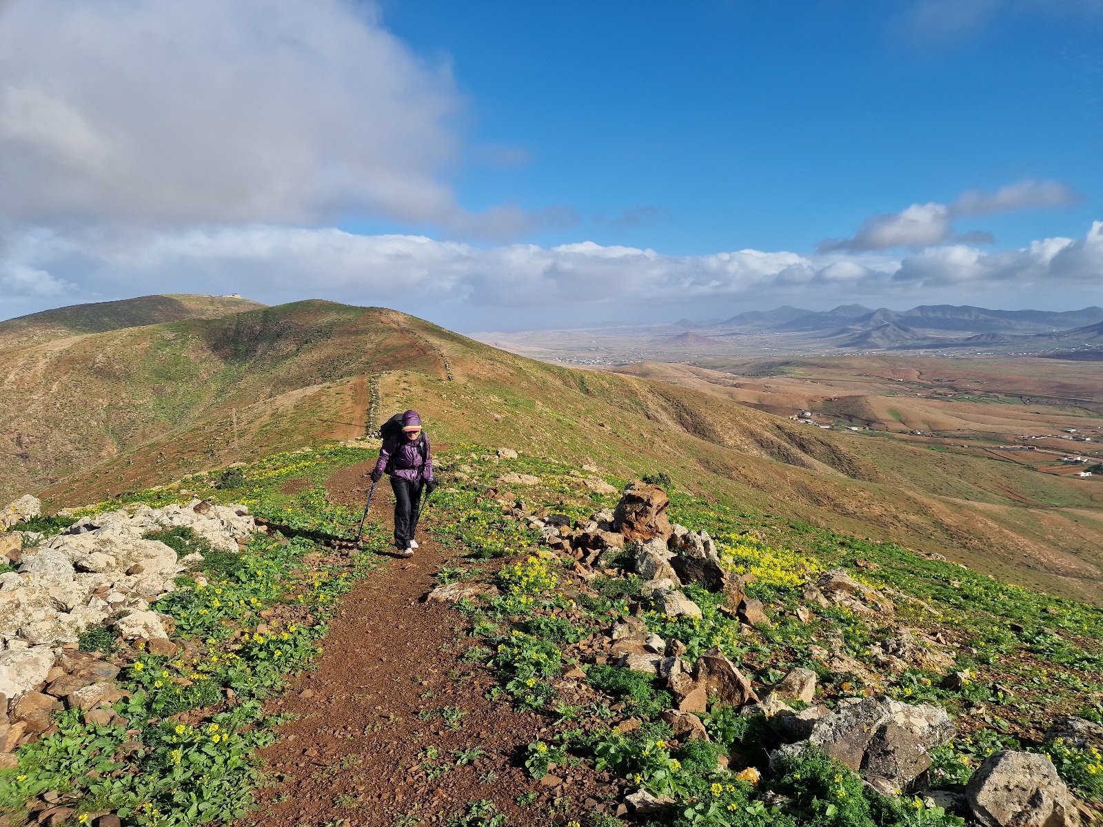
At the top of the climb, we enjoyed a beautiful stretch along the mountain ridge. The only downside was the ferocious wind.


From the ridge, the trail descended into a valley. We eventually followed the valley floor—essentially a dried-up riverbed—for 7 km (4.3 miles) down to Vega de Rio Palma, a tiny village. Inger was struggling a bit with her back on the uneven terrain of the riverbed, so we decided to walk a few kilometers on the paved road to ease the strain. We rejoined the GR131 about 100 meters (328 ft) in elevation below the Degollada de los Granadillos pass.


The ascent was tough, through rocky terrain with gusts so strong they threatened to knock us over. Funnily enough, we found a nearly windless spot to stop for a lunch break. A few bold ravens came to visit; they were clearly used to being fed by humans, but they had to leave us just as hungry as they arrived. We don’t feed the wildlife, even though it’s tempting and entertaining.


Up at the pass, the wind was so intense that sitting down to enjoy the view was out of the question. We had our hands full just staying on our feet!
The route then dropped into the next valley, passed through the village of Toto, and after 17 km (10.6 miles), we reached the slightly larger village of Pájara. We found an open café and a Spar grocery store there. Naturally, we hit the café first before stocking up on resupplies.


We’ve noticed several towns featuring cone-shaped «Christmas trees» made of lights. In Pájara, they had a 20–25 meter (65–82 ft) tall cone covered in crocheted squares, each about 20×20 cm (8×8 inches). It was incredibly impressive and very original.


From Pájara, we hiked about 2 km (1.2 miles) further up a valley until we reached a shelter. With two hours left until sunset and the trail heading back up into high, windy elevations, we decided to stop. The shelter provided a reprieve from the wind and the rain showers that the meteorologists hadn’t predicted.

We chose to end our hike there and set up the tent almost underneath the shelter’s roof. Wild camping isn’t technically allowed on the island, so we got a bit of a startle when the local police suddenly drove by on the mountain road. Fortunately, they passed us without stopping.

The forecast for tomorrow says no rain and lighter winds. Fingers crossed that it holds true!
Today’s stats:
- Distance: 19 km (11.8 miles)
- Elevation gain: 600 meters (1,968 ft)
