GR131 Canary Islands: Day 25 – Friday, Feb 6, 2026
We woke up well-rested after a great night’s sleep at the Hotel Parador de La Palma. It was definitely a step up from our previous accommodations on this trek.
At 8:00 AM, we headed to the lobby to order a taxi. «It’ll be here within ten minutes,» the receptionist promised. She was spot on.
Our driver spoke only Spanish, which led to a bit of a language barrier. We wanted to pay by card, but that wasn’t an option at Refugio El Pilar due to the lack of cell service up there. We had to head back to the front desk for some translation help. The driver wanted me to swipe the card right then for €40. The driver I spoke with yesterday quoted me around €30, but I didn’t have the energy to haggle—it wasn’t an unreasonable price anyway.
The driver navigated the winding roads all the way up to Refugio El Pilar at 1,420 m (4,659 ft). He kept the meter running, and it showed €28.70 when we arrived. He pulled the receipt and actually handed me €11 back in cash. A total class act—I thanked him profusely.
Into the Fog
It was damp and chilly when we started hiking. The temperature was 8°C (46°F), but the humid air made it feel much colder. While the sky was technically clear, mist kept drifting in from the east. Fortunately, it wasn’t as soaking wet as yesterday.
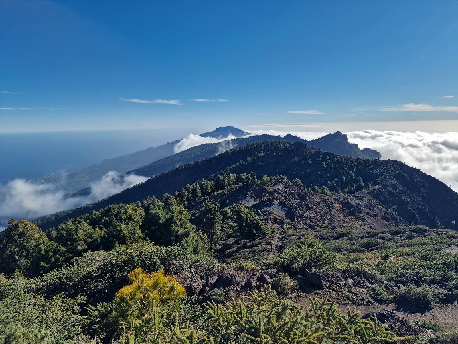
The trail followed a ridgeline, but unfortunately, the views were hidden.
Most of the remaining GR131 on La Palma actually skirts the edge of an enormous crater: the Caldera de Taburiente. The route rounds this massive basin along its steep rim. Usually, the rim is just a narrow spine that offers incredible views on both sides—provided the clouds play along. Below us lies the National Park. The highest point on the rim is 2,424 m (7,953 ft), the island’s peak, which we’ll reach tomorrow.
The first 5–6 km (3.1–3.7 miles) were on a good trail, actually trending slightly downhill, so we maintained a solid pace. Then the climbing began, and our speed naturally dropped. We had a lot of elevation gain ahead of us, so the goal was to conserve energy and save our muscles.

Above the Clouds
As we gained altitude, the fog thinned out, appearing only sporadically but always catching us by surprise. The wind picked up the higher we got, though it never became uncomfortably strong.


Our primary goal for the day was Refugio Punta de Los Roques, which involved a climb of nearly 1,000 meters (3,280 ft). This is an open mountain hut with about 12 bunks.

There, we met Sebastian from Hamburg, who was also hiking the GR131. We spent a lovely afternoon together in the sun on the porch. At 2,030 m (6,660 ft), we were sitting just above the cloud layer, and it actually felt warm. The view was magical, especially looking down into the vast crater. We even took the opportunity to dry the tent (still wet from yesterday morning) on the railing.

We’ve put over 1,000 meters of elevation into our legs every day for the last three days, so we considered stopping there. However, after a warm dinner and a long break, Inger felt energized enough to push on.
The Search for a Campsite
It was only 3:00 PM, giving us about four hours of daylight. Our only concern was finding a suitable spot to pitch the tent along the ridge.

The trail rolled up and down along the edge, featuring some very steep sections—both on the incline and the drop-offs next to the path.
.

For the most part, we were trekking above the fog with stunning views. Honestly, the hike after the Refugio has been the highlight of La Palma so far.


Around 5:00 PM, we started scouting for a spot. We had two requirements: flat ground without too many rocks, and protection from the wind. We quickly realized the first was hard to find on a ridge; combined with the wind, it felt nearly impossible. We were now above the tree line, and the terrain was mostly rock.

We scouted a few spots but rejected them due to heavy wind gusts. The temperature began to plummet—I checked and saw it was only 4°C (39°F). In the wind, it felt much colder. Finding a spot became urgent.
We eventually settled on a sheltered nook right in the middle of the trail. It blocked the path entirely, but we figured no other hikers would be coming through this close to sunset.

Pitching the tent and getting the stakes to hold was a challenge. While the spot was sheltered, it wasn’t calm; gusts were still yanking at the rainfly and guy lines. We hoped the wind would die down after dark.
Once settled inside, I checked the thermometer. It was 1°C (34°F) in the vestibule. Considering we are at 2,300 m (7,546 ft), that’s to be expected. To our huge relief, the wind died down as the sun set, and the temperature dropped below freezing. It became too cold for me to write, so I’m saving the rest for tomorrow night!
• Total for the day: 21 km (13 miles)
• Elevation gain: 1,513 m (4,964 ft)
• Current location: Camping at 2,300 m (7,546 ft), no cell service.
