GR131 Canary Islands, Day 26: Saturday, Feb 7, 2026
As expected, it was a cold night—after all, we are at 2,300 meters (approx. 7,545 feet) above sea level. The temperature dropped below freezing even before it got dark. My thermometer was sitting on top of a pot in the vestibule, and it was likely a bit warmer there than outside.
Our water filter can’t handle freezing temperatures. About half an hour after dark, I realized I’d left it in that pot. I quickly brought it inside, warmed it up in my sleeping bag, and then tucked it between our sleeping pads—my usual «safe spot» when I expect a frost.
I stayed warm through the night, but Inger felt the chill. She seems to get colder more easily with every passing year.
The wind that was tearing at the tent when we pitched it died down completely once darkness fell. The sky remained crystal clear, and I could actually see the brightest stars through the tent fabric. I really should have stepped outside to see the night sky properly.
Just a few kilometers down the crater rim lies one of the world’s most important astronomical sites: the Roque de los Muchachos Observatory (ORM). It houses over 15 different telescopes and scientific instruments from around 20 countries. To prevent light pollution, there is a strict «lights out» policy around the facility after dark, and the access road is closed.
The moon rose at midnight. Even though it was only a half-moon, it was so bright that I didn’t even need my headlamp when I had to step out for a «nature call» later that night.
Around 7:00 AM, I heard Inger was awake and asked if she was ready to get up. To my surprise, she said yes! It was still an hour until sunrise, but the moon was still high enough in the sky that we didn’t need our headlamps to get moving.
I had been worried about condensation, especially on the inside of the tent, since I’d closed both vestibule doors against the wind the night before. However, the tent was bone dry, inside and out.
Chasing the Light
We were on the trail a few minutes before sunrise. A small ridge to our east blocked our view of the sun rising directly from the sea, but we still caught that incredible morning light.


The route continued along the rim, rolling up and down over terrain that was occasionally heavy and rocky.

After about 3 km (1.8 miles), we ran into a young couple from Germany/Austria who were also thru-hiking the GR131 across La Palma. They had camped on the rim as well and shared our struggle of finding a decent, flat spot for a tent.
We started the day wearing almost all our layers—long johns, fleeces, and down jackets were all out of the packs. But during a long climb around the 3 km (1.8 mile) mark, it all had to go back into the bags. The sun had climbed higher and was starting to provide some heat, even if the temperature was still closer to freezing than to double digits.

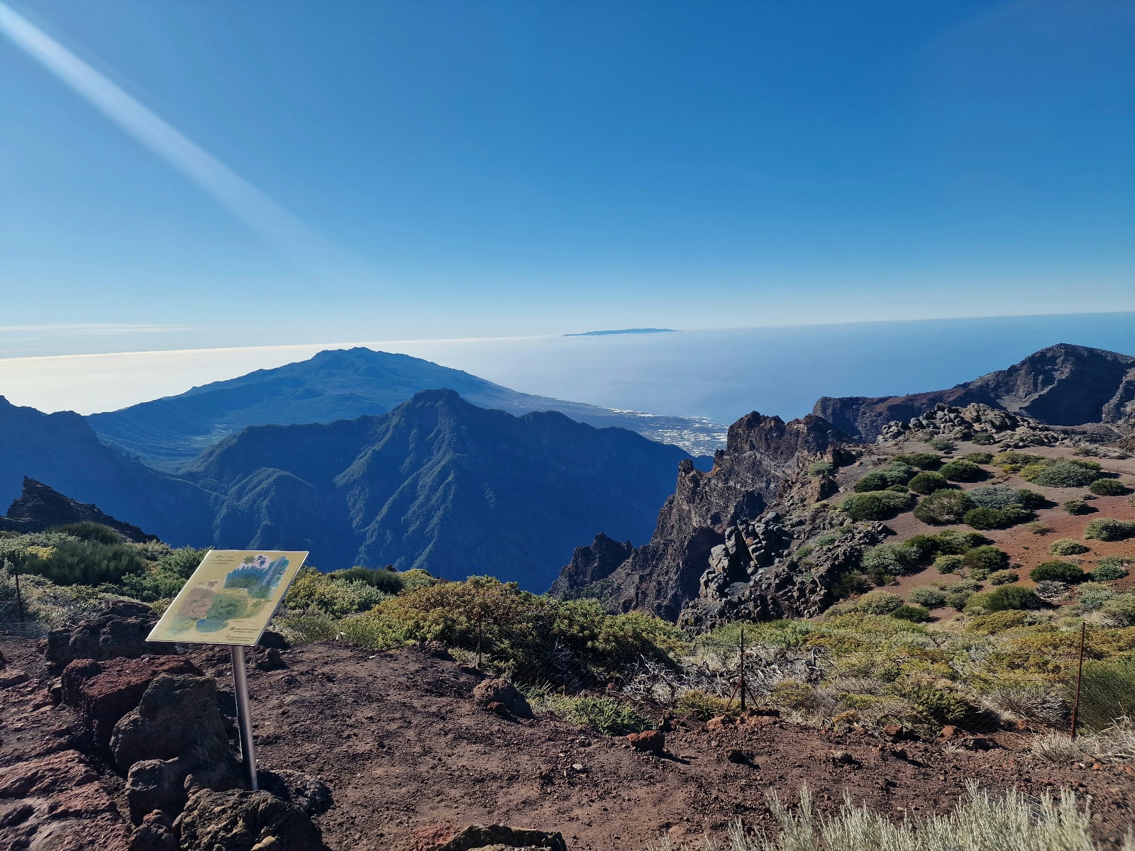
The crater we are hiking around is horseshoe-shaped, offering every view we could have wished for. To our left, we looked down into the massive, steep caldera. Down at the very bottom, the ground was actually lush and forested. On the horizon, we could see the islands of Tenerife, La Gomera, and El Hierro. Way to the east, I believe I spotted Fuerteventura, though Gran Canaria was likely hidden behind Tenerife.


Just before reaching the island’s highest point—2,426 meters (7,959 feet)—at the 6 km (3.7 mile) mark, we passed the white observatory buildings.


The Long Descent
From the summit, we began the long trek down. In several places, the trail was paved with natural stone. While the craftsmanship was impressive and beautiful to look at, we honestly hate this kind of surface. The stones are uneven, making it very easy to trip, especially on a descent. The tips of our trekking poles often get jammed in the large cracks, risking a snapped tip. Fortunately, we made it down without any accidents.


The temperature rose steadily as we lost elevation. At around 1,000 meters (3,280 feet), the landscape shifted into cultivated land, including classic terraced vineyards.


We finally reached the bottom and caught a bus to Hostel Vagamundo in Los Llanos. The bus was absolutely packed, and I had to stand the entire way.


Today’s Stats:
• Distance: 22 km (13.7 miles)
• Elevation Gain: 512 meters (1,680 feet)