Colorado Trail Day 11. Saturday, August 9, 2025.
I woke up around 3:00 AM last night, and Inger claimed she smelled smoke. She has a nose like a bloodhound and can detect all kinds of smells. I didn’t smell anything and told her to go back to sleep.
At 4:30 AM, I woke up and smelled it, too. A strong smell of smoke. I had no doubt what it was: a wildfire. It was almost two hours until sunrise, but there was a full moon, so it wasn’t completely dark. I got out of the tent to investigate. The temperature was a meager 2°C (36°F). The moon was yellow/red because of the smoke.
The smoke «hung» in the valley like a blanket of fog. It was completely still, so it was impossible to tell which direction the smoke was coming from. I couldn’t see any light from flames, and the fact that there was no wind meant there was no immediate danger, but it was uncomfortable to breathe in the smoke.
I went back to the tent, woke Inger up, and said we were breaking camp now, even though it was dark.
We had a quick breakfast and packed up our gear and tent using our headlamps.
We were on the trail an hour before sunrise, hiking by the light of our headlamps. I knew the trail was going to climb a few hundred meters from the start. We would then get higher up and have a better overview of the situation. From my experience on the PCT three years ago, I knew that smoke from wildfires sinks down and settles in the valleys at night. As we walked uphill, I could see small, light particles floating in the air in the beam of my headlamp: ash.
The trail was in the forest the whole time, so it was hard to get a good view, but the smell of smoke became less and less as we gained elevation.
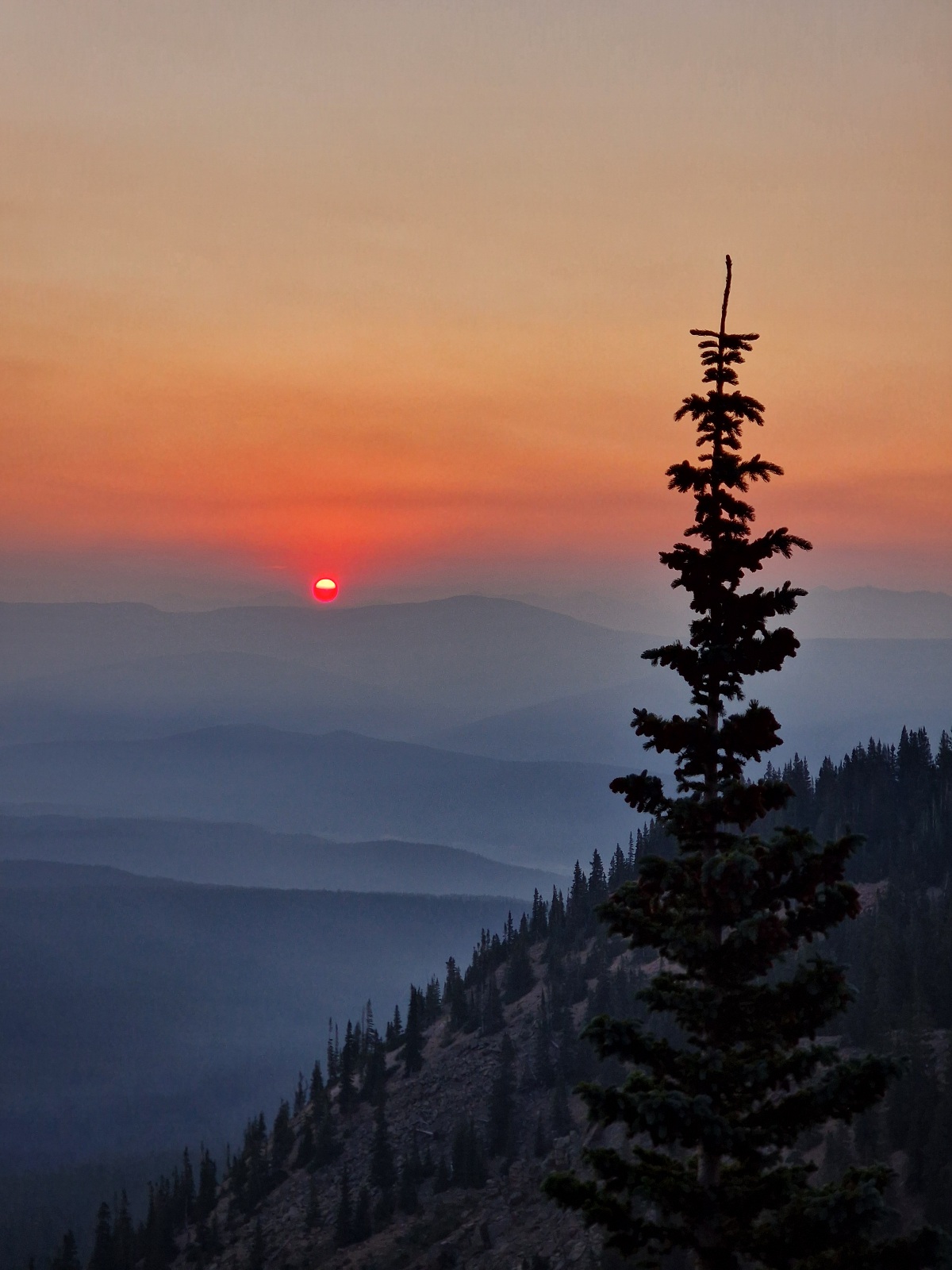
After an hour of hiking, the sun rose, and we were in a clearing. The sun was blood-red, and the smoke lay like fog in the valleys below us. We still couldn’t see where the fire itself was.


As we hiked on, the smell of smoke became fainter and fainter. We had now gained a lot of elevation and were almost at 3,600 meters (11,811 feet) above sea level. The trail then went down to 3,050 meters (10,007 feet), and we noticed the smell of smoke again, faintly this time. We had covered 11 km (6.8 miles) and took a food break. It had been cold until now, and we sat so we could get some warmth from the sun, which was now higher in the sky.

With few exceptions, today’s entire hike was in the forest. It alternated between needle-leaf trees, like firs with short needles, and classic pine trees. The pine forest is preferable as it’s more open and airy, but the ground is often rockier and harder to hike on. We had many such sections today.


We had several climbs of 300-400 meters (984-1,312 feet). We took it easy on the way up, given the conditions, but we still caught up to a hiker from Texas. He tried to keep up with us but had to give up.
We took a long and good break after 16 km (9.9 miles), lying on the ground in the shade of a pine tree. Then we were hiking again, and wouldn’t you know it, we caught up to the hiker from Texas on a long climb. He stopped and stepped to the side when we passed him. This time, he didn’t try to hang on with us.

After 26 km (16.2 miles), we came to a nice campsite with a creek running right nearby, and we decided to end our day there. When we set up the tent, it smelled of smoke. As we always do when we get a chance, we washed our feet and socks in the creek. The trail has been very dusty the last few days.
Today’s section was 26 km (16.2 miles) with 1,145 meters (3,757 feet) of elevation gain. We’re camping at 3,388 meters (11,115 feet) above sea level.