Colorado Trail: Day 18. Saturday, August 16, 2025
We spent the night at the Woodland Motel in Salida and had arranged for Debbie to drive us back to the trail at 8:45 AM, which gave us just enough time to grab a proper breakfast. The motel didn’t offer breakfast, and we really wanted a hearty meal now that we were in town.
We ate at Bunny and Clyde’s Corner Cafe. The cafe was located in an old, abandoned gas station on a street corner. It opened at 8:00 AM, and a minute before, they rolled up one of the old garage doors for what used to be the lubrication bay.
We were their first customers. Unlike yesterday, it was a warm morning, so we chose to sit outside and eat.
Debbie arrived at the cafe right on time, and in the car were two other hikers heading back to the trail. The Colorado Trail has two routes through the Collegiate Mountains. We had originally chosen the eastern route—well, Inger had. Highway 50, which we were now on, crosses both routes, and the other two hikers were taking the western route. We decided to join them since the two routes merge later in the day anyway.
It was chilly when we were dropped off at Monarch Pass, elevation 3,445 meters (11,302 feet). There was also a ski resort at the pass, apparently the only one in Colorado with entirely natural snow.
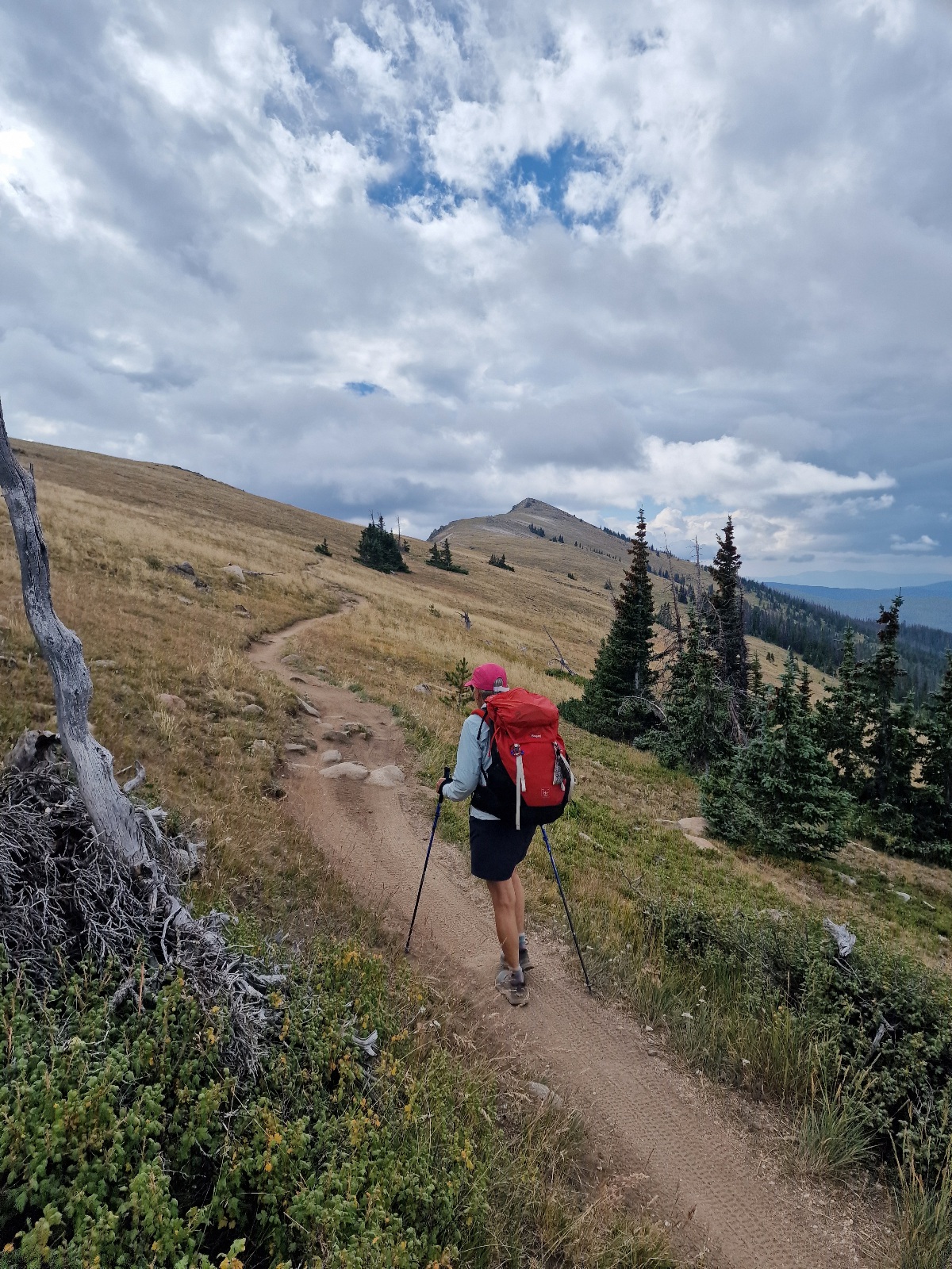
The trail started with gentle ups and downs, occasionally crossing ridges and treeless sections that gave us some great views. It was partly cloudy today, and we could see dark clouds gathering ahead of us.


This section of the trail is also popular for mountain biking. It was Saturday, so we saw quite a few cyclists with mountain bikes at Monarch Pass. Now they were coming in groups of up to five, passing us from behind. Technically, they are supposed to yield to us, but in this kind of situation, it’s the hikers who have to move aside. However, they were polite and considerate as they passed, sometimes at great speed. The first person in the group would thank us for yielding and call out how many were in their group. This way, we knew how many were coming. The last person would usually shout that they were the last one. When the trail is downhill, this happens very quickly, but on ascents, they move at a much slower pace, of course.

It was nice to have some views again on the hike, even though we were in the forest for most of the day. The temperature rose as the day went on. We only met two other hikers while we were on the trail: Mother Goose from Flagstaff and Paul from Denver.
As usual, we took a few breaks to eat and rest. Water was scarce. At one water source, we met Mother Goose and Paul again. They were filling their bottles because the next water source was another 8 kilometers (about 5 miles) away, and according to FarOut, there was barely any water flowing there. I filtered and filled up two liters.


When we reached the second water source, after a total of 24 kilometers (about 15 miles) of hiking, Mother Goose and Paul were there, along with two other girls. There was still a little water trickling between the rocks, and they were taking several minutes to fill a single liter. I, however, found a good spot and managed to fill two liters in 30 seconds, which I then filtered. It started to rain while we were at the water source, and everyone put on their rain jackets. It turned out to be just a few drops again. We’ve been so lucky to avoid real rain on this trip so far.
We finished first and left the water source ahead of everyone else. We were planning to dry camp tonight, but I had over four liters in my pack. Now it was time to scout for a campsite. There were supposed to be a few spots a couple of kilometers farther on. About 4 kilometers (2.5 miles) after the water source, we found a good spot among the trees. As we were almost done setting up the tent, the other hikers passed our spot.
Today’s hike was 28 kilometers (about 17.4 miles) with a 765-meter (2,510-foot) elevation gain.
We’re camping at 2,425 meters (7,956 feet) of elevation.


