GR131 Canary Islands, Day 1: Tuesday, Jan 13, 2026
We’re back on the trail!
We’ve swapped the Norwegian winter—where temperatures have plummeted into the double digits below zero across the country—for the warmer south.
Our destination this time: the Canary Islands.
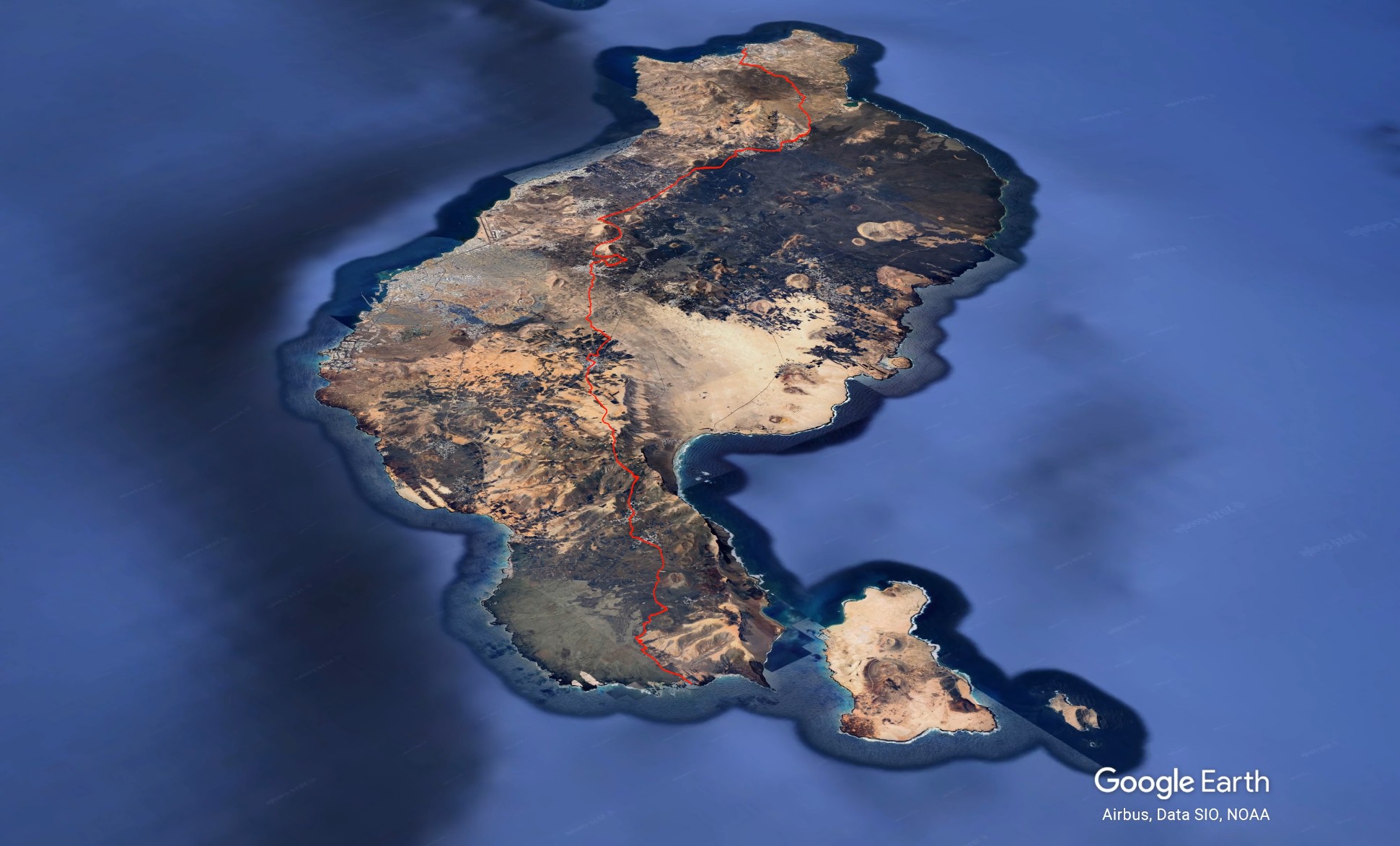
The archipelago consists of seven main islands, with Gran Canaria perhaps being the most famous. While many tourists enjoy hiking the mountains there, few realize there is a continuous long-distance route, the GR131, that spans all seven islands. That is the journey we’ve just begun.

The Canary Islands are volcanic, and Lanzarote is famously known as the «black lava island.» Volcanic rock covers the surface, and it’s incredible to see the work local farmers have put in over generations, clearing the ground of stones to cultivate the thin soil. Stone walls and terraces dominate the landscape.
Our route follows a mix of minor roads and backcountry trails. Fortunately, the trails have been cleared of the roughest lava rocks.


Rain and Roadblocks.
Rain was in the forecast starting at noon, but unfortunately, it arrived an hour early, forcing us into our rain gear by 11:00 AM. After 12 km, we reached the village of Haría, looking forward to a warm cafe to escape the weather. Of course, the two small indoor tables were taken, so we had to make do with a seat outside under a parasol. It turned into a chilly lunch despite layering up.
Since it was too cold to sit still for long, we hit the trail again as soon as the rain eased up.


Finding a Spot for the Night.
The plan was to camp after 17–18 km, and I had scouted a potential area beforehand. Finding a flat, suitable spot for a tent in this rugged terrain is no easy task. We found a decent area when we reached the mark, but even though Inger had specifically asked me during the planning phase not to make the days too long, she was the one who wanted to keep going!
Fair enough. The trail followed a ridge where the wind was whipping, so we pushed on for another 5 km before finding a suitable spot. It’s not perfectly calm, but it’s good enough.


erfect Timing.
I had just managed to pitch the tent and inflate the sleeping pads when the heaviest downpour of the day hit us. We scrambled inside with our packs, feeling incredibly lucky with the timing.

Stats for the day:
Distance: 22.5 km
Elevation gain: 830 meters