GR131 Canary Islands, Day 14: Monday, Jan 26, 2026
We wild camped at 1,700 m (5,577 ft) under the canopy of a pine tree. Luckily, we dodged the dreaded condensation—dry as a bone inside and out—despite the morning mercury dipping to a crisp 2°C (35.6°F).
The forest canopy must have held some heat, because the moment we hit the trail at 08:00 and broke cover, the soil was frozen solid. We had that satisfying crunch of «hoar frost» soil under our boots, and the puddles were skimmed over with ice.

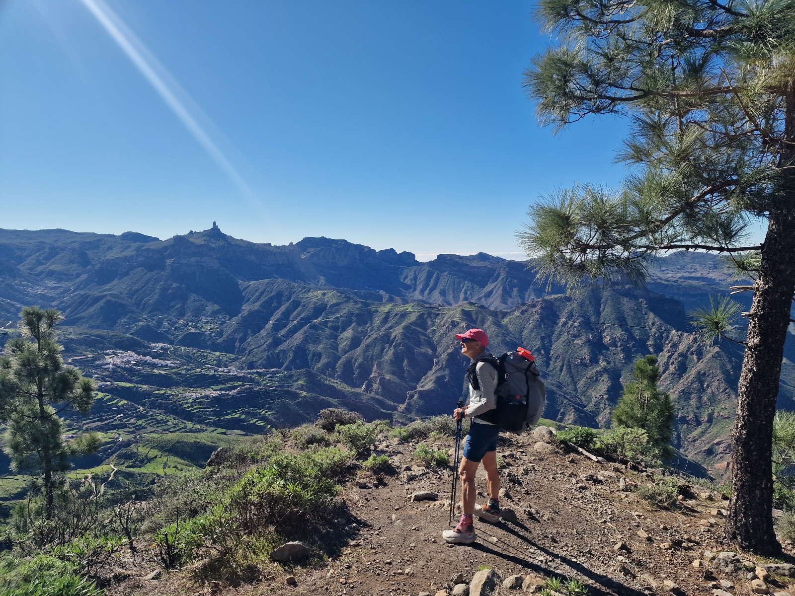
Even with the bite in the air, it was an epic morning to be moving. The western views were pure magic as the sun crested the peaks to the east, slowly bleeding light down the mountain faces.


On the horizon, the snow-dusted peak of Mount Teide on Tenerife looked like it was floating.
Once the sun finally hit the trail, we started shedding layers fast, though the shadows still held a stubborn chill and a layer of frost.


We had a short 4 km (2.5 mile) ridge walk to Cruz de Tejeda—a mountain junction where the GC-15, 60, and 210 meet. It’s basically just a handful of pit stops for hikers and drivers.
Even though we hadn’t put in many miles yet, Inger was craving a caffeine fix. No luck, though; the only café open that early had a €10 minimum for cards. We’re strictly cashless on our treks, relying on the Garmin watches on our wrists for every transaction.
Sure, we keep some «emergency» Euro notes stashed at the bottom of our packs, but a latte didn’t quite make the cut—though some hikers might disagree! Inger, ever the pragmatist, wasn’t one of them.
Our passports are tucked away just as deep. With the new EU laws, accommodations are strict about seeing a National ID or passport. We’ve switched to National ID cards—way less bulky and keeps the passports from getting thrashed on the trail.


The trail kept us working, weaving us up and down along the spine of the ridge. 7 km (4.3 miles) later, we hit the village of Artenara. That final drop into town was a «quad-burner»—steepless stairs cut right into the cliffside.


In Artenara, we grabbed a coffee at a little spot that only served drinks. For fuel, we headed to a nearby shop where we perched outside for lunch while my phone got some «juice» inside. We capped off the break with a four-pack of ice cream. High-calorie trail fuel!

The afternoon was more ridge-running. The payoff? Massive 360-degree views. To the west, Teide was punching through the clouds; to the east, the sprawl of Las Palmas was visible.


We pushed for Area Recreativa Tamadaba for the night. It’s a massive picnic spot with 30+ tables, fire pits, and actual toilets. We rolled in at 17:00 to find the place deserted, so we rolled the dice and pitched the tent right there.

Tonight we’re bunking down at 1,214 m (3,983 ft) in a total «dead zone» (no cell service).
The weather gods stayed on our side today: bluebird skies and prime hiking temps.
Day 14 Totals: 22 km (13.7 miles) with 810 m (2,657 ft) of vertical gain.