GR131 Canary Islands, Day 21: Monday, Feb 2, 2026
Round two on La Gomera.
We decided to «slackpack» yesterday and headed back to San Sebastián to crash at a hotel. The room was nothing special, but man, the breakfast at the café next door was a total win. There’s nothing like starting a long trek with a solid, hearty meal.
The first bus back to the trail didn’t leave until 10:30 AM. It was a wild ride, snaking up the steep, treeless mountainside in what felt like never-ending switchbacks. Once we climbed about 1,000 meters (3,280 ft), we hit the forest line and the views just… disappeared. We were suddenly swallowed by thick fog. Luckily, no rain yet!
We hopped off the bus at 11:15 AM right where we left off. Back in San Sebastián, it was a beautiful 20°C (68°F) and sunny—total t-shirt and shorts weather. Up here at nearly 1,350 m (4,430 ft)? Not so much. It was noticeably chilly in the fog, so we had to layer up before hitting the trail. Thankfully, it wasn’t windy, but it was another late start for us.
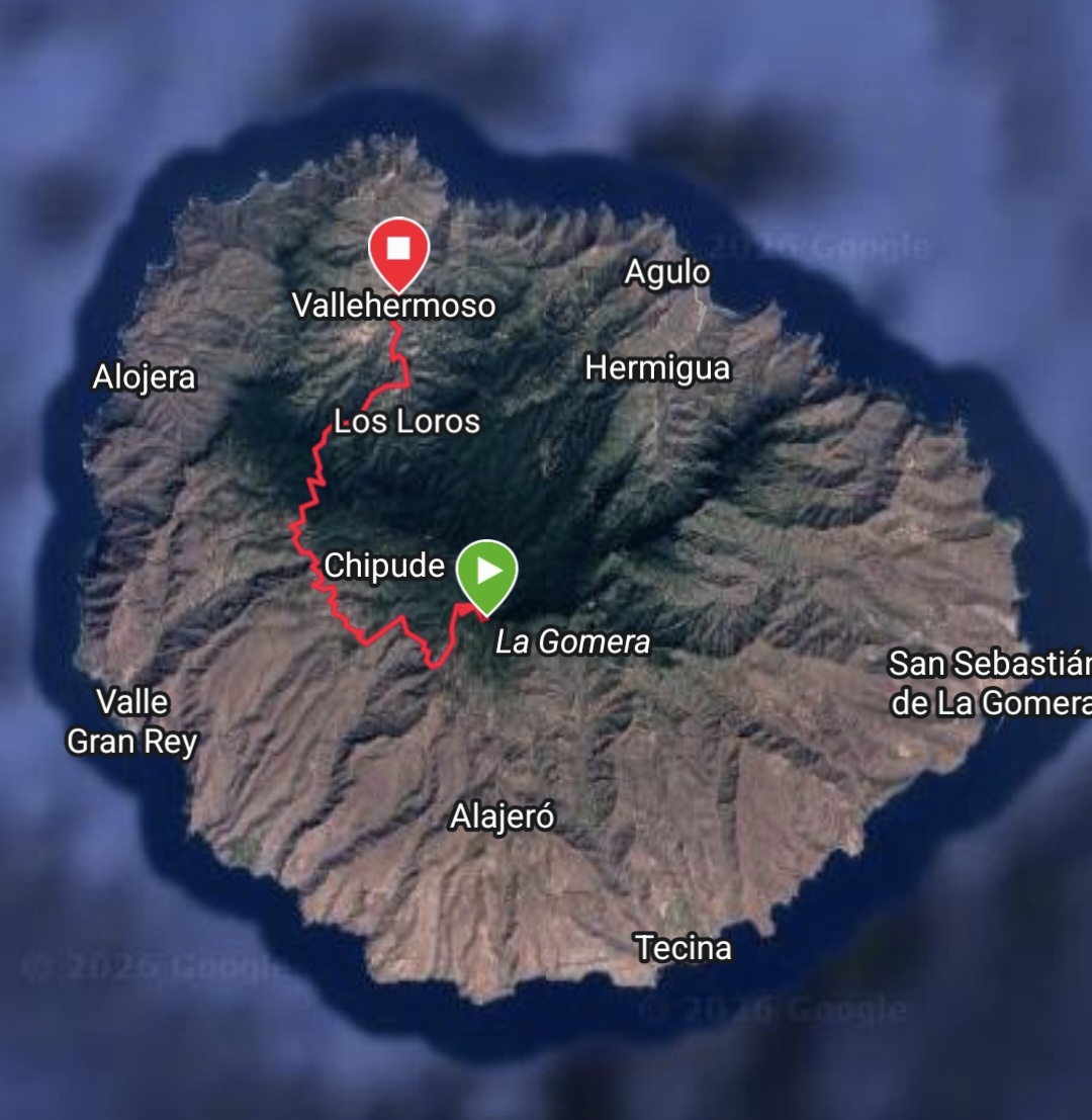
The trail started climbing immediately, and before we knew it, we were at the highest point on the island: 1,438 m (4,718 ft). There was an overlook there, but with the fog, we couldn’t see a thing.

From there, the trail was a bit of a roller coaster, though mostly heading down along these lush, forested ridges. As the fog started to lift, the views were insane. We could see these massive, deep valleys dropping away below us. The path got pretty sketchy and exposed in some spots—definitely the kind of place where you don’t want to take a tumble.


After 9 km (5.6 miles), we rolled into the village of Chipude. We’d already grabbed some supplies at a bakery in San Sebastián, so we just hit a tiny local shop for some drinks and found a bench in the square to eat.
Most of these little mountain villages have these great, cozy squares where you can just sit and people-watch. This one, though, felt a bit «meh»—maybe it was just the fog drifting across the plaza that made it feel a little gloomy. We could actually feel the moisture in the air on our legs. We were still way up at 1,100 m (3,600 ft).
While we sat there, we did the math on where to sleep. We had 18 km (11.2 miles) of the GR131 left on the island, but there was no way we’d make that before dark. We figured we could reach the town of Vallehermoso in 15 km (9.3 miles). Booking.com showed one last hotel room available, so we snagged it. Best decision ever.
As we were leaving Chipude, navigating the narrow backstreets, we ran into a bit of a snag. A small rockslide was blocking the path between two buildings.


We managed to scramble over the rocks, but as soon as we rounded the next corner—BAM—wind and rain hit us full force. It came out of nowhere! We ducked back behind a house to scramble into our rain gear.
The forecast hadn’t mentioned rain, and I kept hoping it was just a passing shower, but it stuck with us for hours. It wasn’t a crazy downpour, but definitely wet enough to keep the shells on.


The trail dipped in and out of steep valleys before leveling out for a bit. After crossing the GM-2 road, we huddled in a bus shelter for a quick snack before the final descent from 1,100 m (3,600 ft).
The hike down was steep in spots, but luckily the ground wasn’t too rocky or slippery. The rain finally quit as we lost altitude, and the fog cleared just in time to show off the massive, dramatic valley we were walking into.


We followed the valley floor all the way into Vallehermoso, arriving about 30 minutes before sunset. Both Inger and I were so glad we booked that hotel. Camping in the damp is never fun, even if you’re used to it. Plus, looking at that vertical terrain for the last 15 km (9.3 miles), I didn’t see a single spot where you could actually pitch a tent!


Today’s Stats:
• Distance: 24.5 km (15.2 miles)
• Elevation Gain: 560 m (1,837 ft)