GR131 Canary Islands: Day 31 – Wednesday, Feb 11, 2026
The forecast for today looked promising, calling for clear blue skies. However, when I got up briefly during the night, the area was shrouded in fog—and it was still there when we woke up. It was thick, too; I couldn’t even see the houses at the end of the street.
After two nights in our apartment in Valverde, we were ready to cross the final island: El Hierro. I was feeling decent considering the circumstances, though my appetite was completely gone. I had to force myself to eat.
As we were getting ready to leave, we were happy to see the fog finally lifting. The sun came out, and it turned into a beautiful day, so we packed away our jackets.
We wound through the narrow streets of the small town, passed through the center, and hung a right. The trail headed steeply uphill. At the next intersection, it got really steep. You can only have streets like that in places where there’s no risk of snow or ice!
We had a lot of elevation gain ahead of us today—over 1,000 meters (3,280 ft)—so we took it slow on the climbs. There’s no point in burning all your energy at the start, even when the body feels like pushing a faster pace.

A Different Kind of Island
As we left the houses behind, it hit us immediately: El Hierro is nothing like the other Canary Islands. It’s lush and incredibly green. The grass wasn’t just thick; it was tall, with a huge variety of plants. As we climbed higher, we came across green meadows where cows were out grazing—something we haven’t seen yet on this trip.


After 5 km (3.1 miles), the trail leveled out and the hiking became easier. We were now at an elevation of about 1,000 meters (3,280 ft). A short while later, we crossed a road with a sign pointing toward San Andrés. It was slightly off-trail and is the only urban area the route passes on the island.
I told Inger that if she wanted a cup of coffee, we could take a detour into the village. She’d already had two cups this morning, but she can never resist the combination of coffee and a break. We changed course and followed the road into San Andrés.
Even though it’s a tiny village, it had two cafes. We chose the one with a single table and two chairs outside. This wasn’t a «tourist trap»—the local clientele and the prices gave that away. We ordered two cappuccinos for €1.50 each.
Even though this isn’t a typical tourist destination, we weren’t the only ones who found it; we met Barbara from Germany there. She came over and asked if we were hikers. Inger grabbed a chair from inside and invited her to join us.
Barbara is a retiree who loves hiking—not necessarily fast, but for the experience of being in nature. However, she didn’t have anyone to hike with, so we spent some time discussing the challenges of finding a hiking partner. We swapped stories until she had to catch the bus to Frontera and we had to head back to the GR131.
The trail continued upward through easy terrain that felt very «un-Canarian.» The ground was easy on the feet, often following old gravel roads. When it was time for lunch, we actually found a picnic table and benches. The area looked almost like a park, filled with massive, tall trees.


Around the 15 km (9.3 mile) mark, we reached Fuente de la Llanía, where there was supposed to be a water station. We couldn’t find it, but it wasn’t a crisis since there was another one about 3 km (1.8 miles) away. We had to find water there, or we’d be in trouble. Fortunately, we found a station with several taps. I filtered about 3 liters (0.8 gallons), though to our disappointment, the water had a bit of an aftertaste.


The route followed the ridgeline along the steep northern drop-off. We could hear the swells crashing against the cliffs far below, but the fog sitting over the lowlands blocked the view. Eventually, the trail climbed to the highest point on the island, Malpaso, at 1,501 meters (4,925 ft), which features a scenic lookout.


At Malpaso, there was a unique installation: a 2–3 meter high structure with dense green netting, acting as a filter. It’s a fog collector. When the fog and wind hit it, tiny water droplets cling to the mesh and drip down—essentially mimicking how pine needles collect moisture.

Camping on the Edge
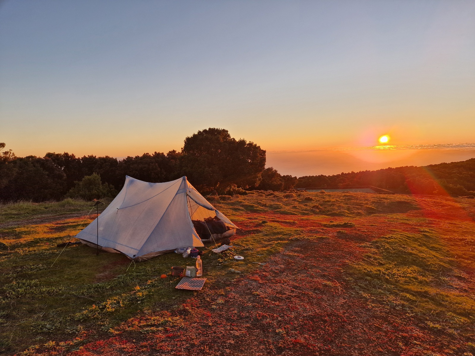
After Malpaso, the trail began to descend along the ridge heading west. After 5:00 PM, we started scouting for a campsite and eventually found a great spot a short distance from the trail. Interestingly, there was another fog collector right near our site.

I ate dinner outside and finished my last spoonful just as the sun dipped below the western horizon. We are camped only 10 meters (33 ft) from the steep northern edge. Down there, about 400–500 meters (1,300–1,600 ft) below us, lies a massive sea of fog.


Today’s trek on El Hierro was spectacular—easily one of the best days of the entire trip. Tomorrow, we’ll eventually have to descend into that sea of clouds.
Today’s Stats:
• Distance: 25 km (15.5 miles)
• Elevation Gain: 1,160 meters (3,805 ft)
• Campsite Elevation: 1,240 meters (4,068 ft)