The Colorado Trail: Day 1
Wednesday, July 30, 2025
We were staying at a hotel about three kilometers from Union Station in downtown Denver, but still within walking distance of the city center.
The Colorado Trail Association has a list of volunteers, called «trail angels,» who can help with transportation from Denver to the trailhead. It’s about a 45-minute drive. We contacted Doyle via email, and he was willing to drive us. We arranged to be picked up at 7:00 AM, which gave us just enough time to eat breakfast at the hotel, which started at 6:30 AM.
At 7:00 AM sharp, Doyle arrived and drove us to the trailhead. First, however, we stopped to visit another trail angel named Bill, just a few kilometers from the trailhead. I had ordered a new, super-lightweight tent, of course, from the small American company Zpacks—it’s the third tent I’ve bought from them. Bill had agreed to have the tent delivered to his address. Among other things, Bill has arranged several «Trail Magic» events for hikers and plans to have more throughout August.
When we arrived at the trailhead, I tried to give Doyle $20 for the ride, but he refused. The Colorado Trail Association had informed us that the drivers don’t expect any compensation, but I still wanted to give him a tip. Doyle has hiked and biked the Colorado Trail himself and has received help from trail angels. This was his way of paying it forward.
The system of trail angels that Americans have is fantastic. We experienced the same thing during a previous hike in the USA.
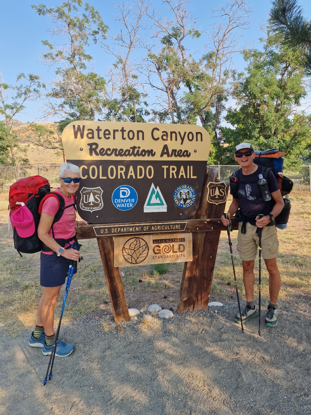
After thanking Doyle for the ride and taking some photos at the trailhead, we started our hike at 8:15 AM. When we arrived in Denver a few days ago, the temperature was 36°C (97°F). It had been hot for a long time, but luckily, the temperature had dropped to 26°C (79°F) today. However, thunderstorms and rain were forecast for the afternoon.
The first part of the hike was on a gravel road through Waterton Canyon. The road is about 10 kilometers long and climbs gently up to a dam. Along the way, we saw Rocky Mountain Bighorn Sheep, as there are herds that live on the canyon’s slopes. We also spotted a rattlesnake on the side of the road, rattling its tail and looking threateningly at us.
After about 10 kilometers, we left the gravel road and began our climb on a trail that ascended relatively steeply through the forest before descending to a small stream called Bear Creek. It’s another 12 kilometers to the next water source, so most hikers fill their water bottles here. That was our plan, but we still had plenty of water, so we continued after a short break. At the stream, we met Beatnick and young Oats, as well as Taylor. They were all from the USA, but they weren’t hiking together.
The trail then climbed 400 vertical meters (about 1,300 feet) to the highest point of the day at 2,300 meters above sea level (about 7,545 feet), all while winding through the forest. Rain and thunderstorms were in the forecast, and we noticed the sun disappearing behind the clouds. At 1:00 PM, we heard the first thunderclap ahead of us. Many more followed, but thankfully, there was no rain yet. The temperature dropped from 26°C (79°F) to 18°C (64°F). Just before reaching the highest point, it started to rain, and we put on our rain gear. It can rain heavily during these thunderstorms, but we were lucky; we only got light rain, even though the thunder was booming right over us.
The trail then went downhill, and after 27 kilometers, we reached the South Plate River. This is a large river, and after crossing it on a bridge, we found a nice campsite right by the water. While we were setting up, I almost stepped on a snake that was lying still. Luckily, it was a harmless garter snake.
There are bears in the area, so we packed all our food into a special bag, a Kevlar Ursack we bought at REI in Denver. I tied the bag to a tree some distance away from the tent. It’s pointless to try and hang it from a rope because a bear will get it regardless. The bag is so strong that it can’t be torn to pieces.
Today’s stage was 27 kilometers (about 16.8 miles) with an elevation gain of 800 vertical meters (about 2,625 feet).


