The first two days of our trip were overcast. Late at night, some might say early in the morning, around 4 AM, there was a break in the clouds, and the sun made it warm in the tent. I lay half-naked without my sleeping bag. That’s how it is here north of the Arctic Circle.
I’ve had between 300 and 400 tent overnights in the summer over the past 6 years, and the warmest nights have been north of the Arctic Circle. Last year, we hiked in the Arizona mountains and had about 20 nights with frost and similarly cold mornings.
Today, we could sit in t-shirts while eating breakfast, not bundled up in sleeping bags as we’re used to in the mountains further south.
The glimpse of sun didn’t last long; it was overcast when we got up. The temperature was still high, and we didn’t walk far before I was hiking in shorts and a t-shirt. The wind, which kept the insects away, was pleasant, and I realized the temperature was in the 20s Celsius (70s Fahrenheit).
I got some cell phone reception in the morning, posted yesterday’s trip log on Facebook, and checked the weather forecast. Uh oh, the radar showed rain coming in about an hour. When the first drops came, we put on our rain gear, but we could have saved ourselves the trouble. It was only light rain, and at this temperature, it wasn’t an issue. After a while, we were back in t-shirts and shorts even though it was still dripping from the clouds.
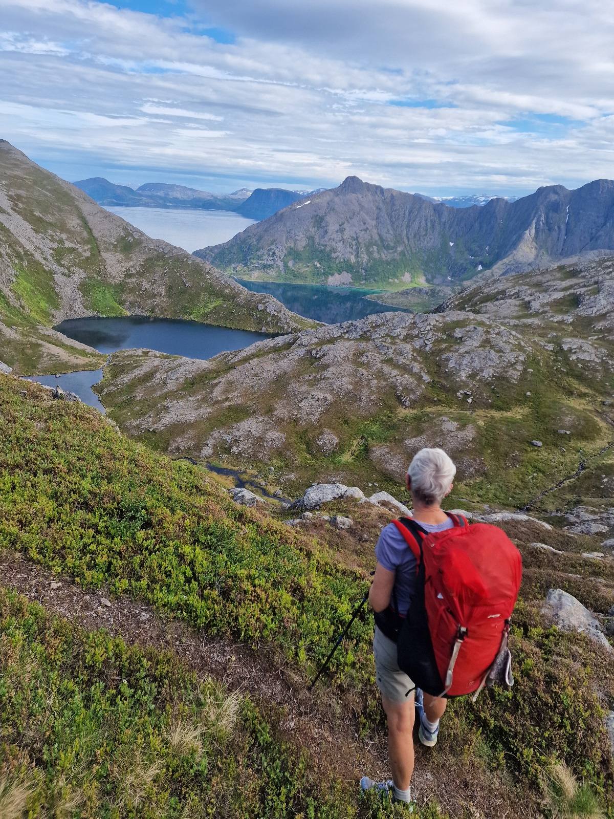
On the first two days, the trail went significantly up and down through very hilly terrain. Today, the terrain was more varied but gentler. The ground was also easier to walk on. The landscape changed constantly, and it was undoubtedly the most beautiful day so far on this trip.
The rain stopped after two hours, and it became partly cloudy. The temperature was 23 degrees Celsius (73 degrees Fahrenheit), and the glimpses of sun made it warm. We took breaks where there was a bit of wind to keep the insects away. In a small lake, I took a swim and then changed into clean clothes. It was pure bliss.
We met one hiker today who had started at Tarhalsen and was heading to Fuglen. In addition, we met a family with 6 children who were hiking almost the hole route. Truly impressive! The youngest child was only four years old. It’s probably unnecessary to mention it, but the father had a very heavy backpack. I’ll mention it anyway, even though the children (except the 4-year-old) also had backpacks. Yes, the mother also had a load on her back.
We didn’t see any reindeer today, but we passed a reindeer fence that seemed to stretch across the island.


Along Langvatnet, we hiked on grass and heather-covered plains before descending into the terrain and crossing several rivers.

Between Sandøybotn on the outer side of the island and Slettnesfjorden on the inner side, there’s one of the narrowest points on the island. We walked there, at 400 meters (approx. 1,312 feet) above sea level, and had fantastic views to both sides.
On the plateau of Kuvikfjellet, which is the route’s highest point at 470 meters (approx. 1,540 feet) above sea level, we walked through a rock desert.


On our way down from Kuvikfjellet, we saw the fog drifting over the mountains to both the north and west, and we realized it was time to put on more clothes.
We finished our hike in Låterbukta, where there’s an express boat pier. The boat arrived just as we did, and we witnessed the moment when expectant and excited holidaymakers arrived on the island. A gravel road leads from the pier to Båtsfjord and Sandøybotn on the outer side of the island. A caravan of cars transported all the passengers there.

We made dinner in the waiting room at the pier and pitched our tent on the now deserted road towards Langstrandfjorden.
Today’s stage was 27 km (16.8 miles) and 977 meters (3,205 feet) of elevation gain.


