Sørøya Lengthwise Day 5: Last Day
On Day 4, we took a detour down to Hellefjorden to visit family and friends, and stayed there for two nights before returning to our hike.
Sondre drove us the five kilometers (3.1 miles) on the narrow, bumpy gravel road from Hellefjorden to the point where the route crossed the road.
At 9:30 AM, we were hiking. It was partly cloudy at the start, and we were well-dressed for the windy weather. Eventually, the clouds disappeared, the temperature rose, and I hiked in a t-shirt and shorts.

The route led us over two ridges before descending to Finnvika and Storsand. This is the route’s first encounter with the ocean on the outer side of Sørøya. Storsand lives up to its name; the large white beach boasts beautiful white sand. Inland from the beach itself are classic white sand dunes with scattered vegetation.


In Nordbukta, at the northern end of the beach, we met the gravel road that runs from Akkarfjord to Finnvik. We followed the road for just under two kilometers (1.2 miles) to the two farms in Finnvik and then followed a trail to Sandfjellet. Sandfjellet is also a well-descriptive name. On the north side of the mountain, on the way down to Sandfjellstranden in Gamvik, there was loose white sand. It felt like we were walking on snow, and the wind had blown the sand into formations and drifts as if it were snow. The descent was very steep in the loose sand.


On the north side of the mountain, a flock of reindeer sought shelter from the sun in the mountain’s shadow.
From Gamvik, we continued over ridges to Kjøttvikvannet, Vassvikvannet, and the plateau on Høgfjellet, 290 meters (approx. 950 feet) above sea level. Now, we had the route’s northern endpoint, Tarhalsen, in sight. It was blowing hard here, and fog was drifting rapidly from the west.

From the northern end of the plateau, there’s a very steep descent into the cliff landscape to Tarhalsskaret, where the DNT cabin, Tarhalshytta, is well hidden yet exposed to the treacherous forces of the Arctic Ocean. The hut is only a few meters above sea level.

The path down is secured with railings where it winds down the mountainside.
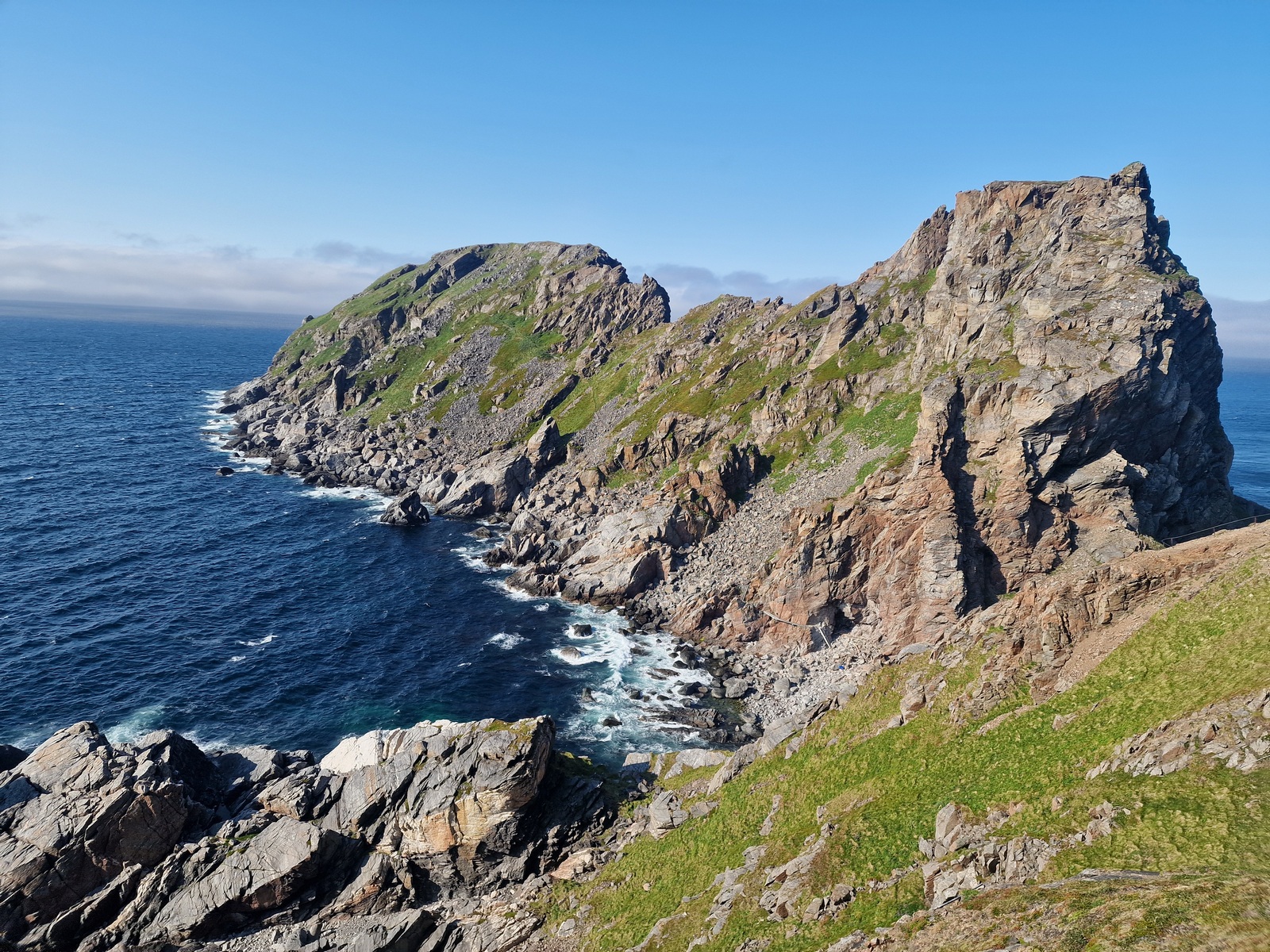
Further from the hut in the pass, the trail continues up the west side of the cliffs, ascending some ladders in steep terrain to a plateau 130 meters (approx. 426 feet) above sea level. Here too, the trail is secured with chains and railings in the steepest and most exposed sections. These came in handy in the strong wind.
At the northern end of the plateau is the lighthouse, which marks the northern endpoint of the Sørøya lengthwise route. Oddly enough, there were no information signs here.


We were incredibly lucky that it was sunny and fog-free on the way out to the lighthouse, giving us a clear view. On the way back towards Tarhalshytta, the fog rolled in, enveloping everything in a white, damp veil.
We didn’t end up staying in the hut. We returned through dense fog and strong wind for seven kilometers to Gamvik, where we looked for a sheltered spot to pitch our tent. Then, we discovered that it was only two kilometers further to the Gamvikvannhytta. This is an open day-use cabin where it’s also possible to sleep on the floor. We chose this option.
The return journey was entirely in dense fog and wind. Tomorrow, we’ll walk the just over three kilometers (1.9 miles) to Akkarfjord, where we’ll leave Sørøya.

Today’s stage was 30 km (18.6 miles) and 1,630 meters (5,348 feet) of elevation gain.