The Colorado Trail: Day 2
Thursday, July 31, 2025
The sun sets here around 8:15 PM, and I was already fast asleep before it was completely dark. We had agreed to wake up a while before sunrise, which is at 6:00 AM. I woke up at 5:00 AM and finished writing my log for the day. I then woke Inger up at our agreed-upon time.
The Ursack, which held our food, was untouched during the night. I retrieved it from where it was hanging on a pine tree. There are rodents here, but the bag’s construction prevents them from getting to our food.
We hit the trail by 6:30 AM. It’s about 15 km to the first water source, and hikers are advised to start this section early. The route goes through an area that was affected by a forest fire, so there’s no shade from the sun. The steep climbs mean you can get very thirsty, very quickly.
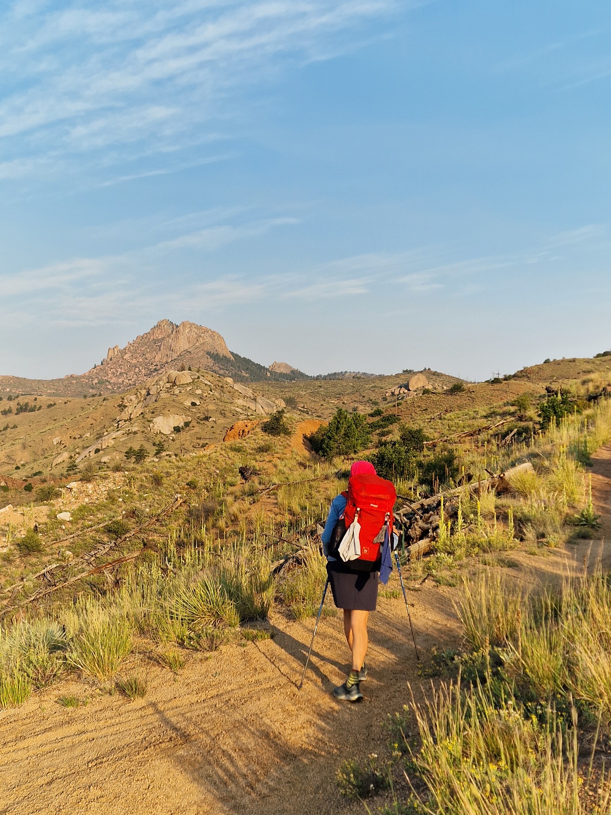
The trail climbed 600 meters before flattening out in the burned area. It’s been almost 30 years since the fire, and all the trees that were left standing have since fallen. The trees rarely burn up in these kinds of fires, but they die and stand for a few years before they fall down. The trees closest to the trail were sawed down, likely to prevent them from falling on a hiker. These dead trees are known as «widowmakers.»


After a forest fire, new vegetation always appears. There were flowers of every color and small pine trees competing for space with other bushes. Last year in Arizona, we saw how the pine trees had to make way for scrub, at least in the short term, after similar fires.
We took our first food break after 10 km. We made sure to dry out our tent at the same time. It was a clear night, which usually leads to condensation both inside and outside the tent. We make it a habit to dry it out during breaks.
After 15 km, we reached a road with a fire station where we were able to fill our water bottles. The next water source is another 17 km away, which we won’t reach today. This means we need water for dinner, tonight, breakfast, and tomorrow morning. Setting up camp without a water source is called a «dry camp.»
We filled up our bottles, and I ended up carrying 5.5 liters in my pack. You can definitely feel the weight! It’s probably too much, but we wanted to be sure we had enough water.

Two and a half kilometers past the fire station, we reached the Little Scraggy Trailhead. There’s a road and a parking lot with picnic tables and toilets. We took a longer break there. The sky had clouded over, and when we heard the first clap of thunder, we got ready to continue hiking.


After a little over a kilometer, we came to a gravel road and a sign that said «Trail Magic 50 meters to the right.» All hikers love trail magic, and we’re no exception. Trail magic is when volunteers set up a spot to serve hikers, offering everything from drinks and fruit to snacks and even full meals.

It was a guy who went by «Caveman» who was hosting this trail magic. We got chairs to sit on and cold drinks. He offered to cook for us, but we had just eaten, so we politely declined.
Caveman was a 45-year-old former hiker. He’s hiked the Colorado Trail, the PCT, and the Appalachian Trail twice. Now, he has injuries from a fall and no longer hikes.


While we were sitting there, we heard the thunderstorm continue and felt a few drops of rain. After a half-hour with the talkative Caveman, we thanked him and continued on our way.

We thought the rainstorm had passed us by, but after another kilometer, it started raining enough that we put on our rain gear. Luckily, it was only a light rain, and our gear kept us dry.
After hiking 24 km, we found a nice campsite and decided to end our day there. The thunder was still rumbling in the distance, but there was no more rain.

We only saw one other hiker today, Taylor. He hasn’t gotten a trail name yet, and I suggested he could be Pink Panther, or just «Pinky.» He nodded and said, «Yeah, it has to be something with pink.»
Pink is definitely his color.
As for wildlife, we saw a rabbit, a squirrel, and a green snake of an unknown species today.
Today’s section was 24 km and 905 meters of elevation gain.
We’re camping at 2360 meters above sea level.
