Colorado Trail Day 12. Sunday, August 10, 2025.
Even though we camped at 3,388 meters (11,115 feet), it was 8°C (46°F) and clear when we woke up today. Luckily, there was no smell of smoke, even though we caught a hint of it during the night.
We were hiking by 7:00 AM. The trail climbed from the start, but today’s elevation gains would be well under half of what we had yesterday. Today, too, there was a lot of hiking in the forest without much of a view.

After about 13 km (8.1 miles), we entered a deciduous forest, likely aspen. It looked like someone had been chopping down trees with an ax. Some trees were still standing even though they had been cut into. It looked a bit strange. There was a stream nearby. There, I saw a beaver lodge and a beaver dam. It was the beavers that were the lumberjacks!

As we continued along the stream, we saw many dams and lodges the beavers had made. It’s incredible what these animals can accomplish.


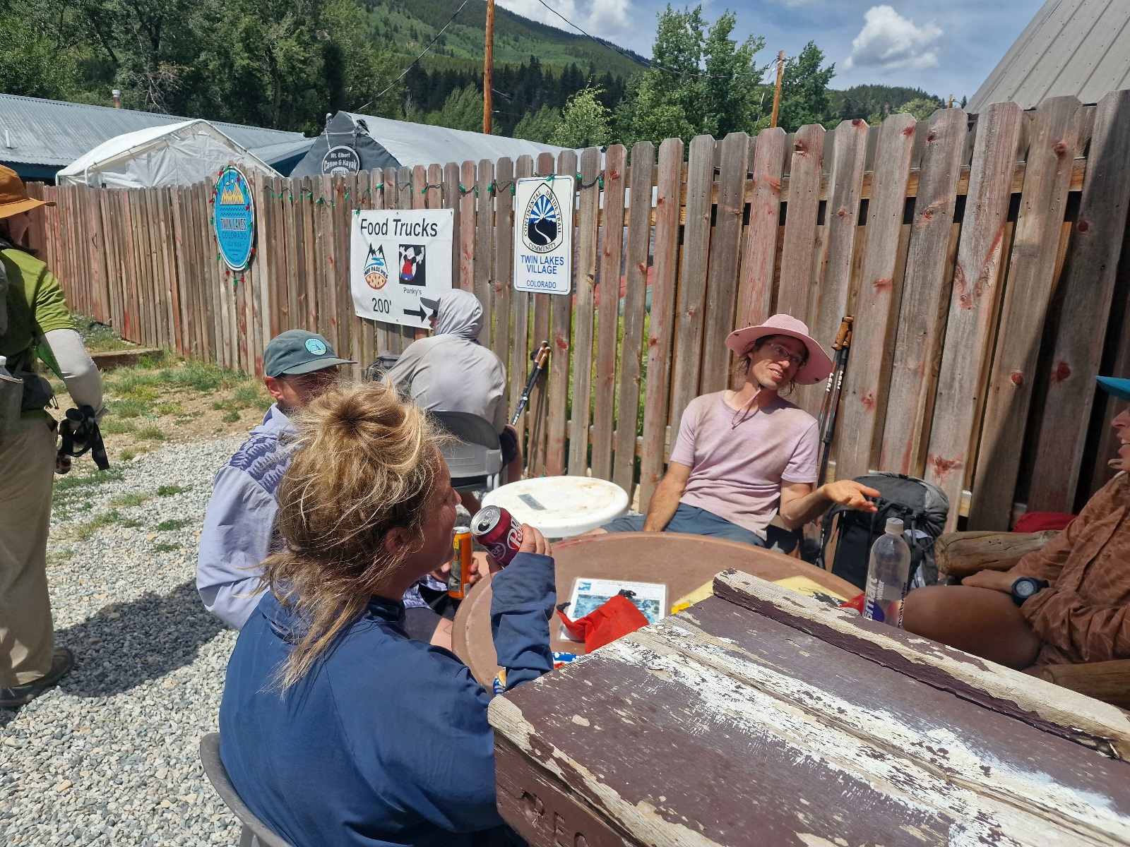
Our primary goal for the day was Twin Lakes Village. As the name suggests, it’s located by the two lakes called Twin Lakes. We arrived there just after noon, after hiking 20 km (12.4 miles). It’s not a big place—I barely know if there are any permanent residents—but they have a General Store, a few simple restaurants, and lodging. The place thrives on the traffic from Highway 82, but most of the food spots close for the winter when Independence Pass, at 3,680 meters (12,073 feet), shuts down.
Inger and I were in Aspen, on the left side of Independence Pass, during the last week of May last year. We had planned to drive over the pass, but it hadn’t opened for the season yet.


Outside the General Store, we met many familiar hikers we had seen before, and it was a nice reunion. Inside the General Store, it was bustling with customers, and we were able to buy everything we needed.
Afterward, we «hung out» with the hikers outside the store. There are always great stories and lots of laughter in settings like this, and we shared our experiences. A special bond forms among hikers on these long trails. We experienced the same thing on the PCT and the Arizona Trail.

We ate pizza, drank a few liters of Coke, and charged our electronics at the outlet outside the store.
The Colorado Trail has two different alternate routes for the next 125 km. The standard route follows the eastern path. The western route is an alternative that goes higher in the terrain and is more exposed to thunderstorms but offers better views. Most of the hikers outside the store were going to try the western alternate. Inger wanted to take the eastern one, so that’s what we’re hiking.
We weren’t going to stay in the Village—it’s a bit off the trail—so after being there for four hours, we hitchhiked back to the trailhead with another girl. We stood by the road for about 10 minutes before a car stopped and picked us up.
We then hiked until we crossed the dam at the eastern Twin Lake and camped there.

Today’s section was 22 km (13.7 miles) with 460 meters (1,509 feet) of elevation gain. We’re camping at 2,830 meters (9,285 feet) above sea level.