Day 14 on the Colorado Trail. Tuesday, August 12, 2025.
We camped at the bottom of the valley, right next to Pine Creek, with no trees nearby. I was worried we might have a cold night with a lot of condensation, and I was right. The cold air sinks into the valley bottom, and there was condensation on the inside of the tent roof. When we got up, it was -2°C (28°F) outside the tent. It’s always a little warmer inside than out. There was frost on the Ursack, where we keep our food, which was tied to a stick outside the tent.
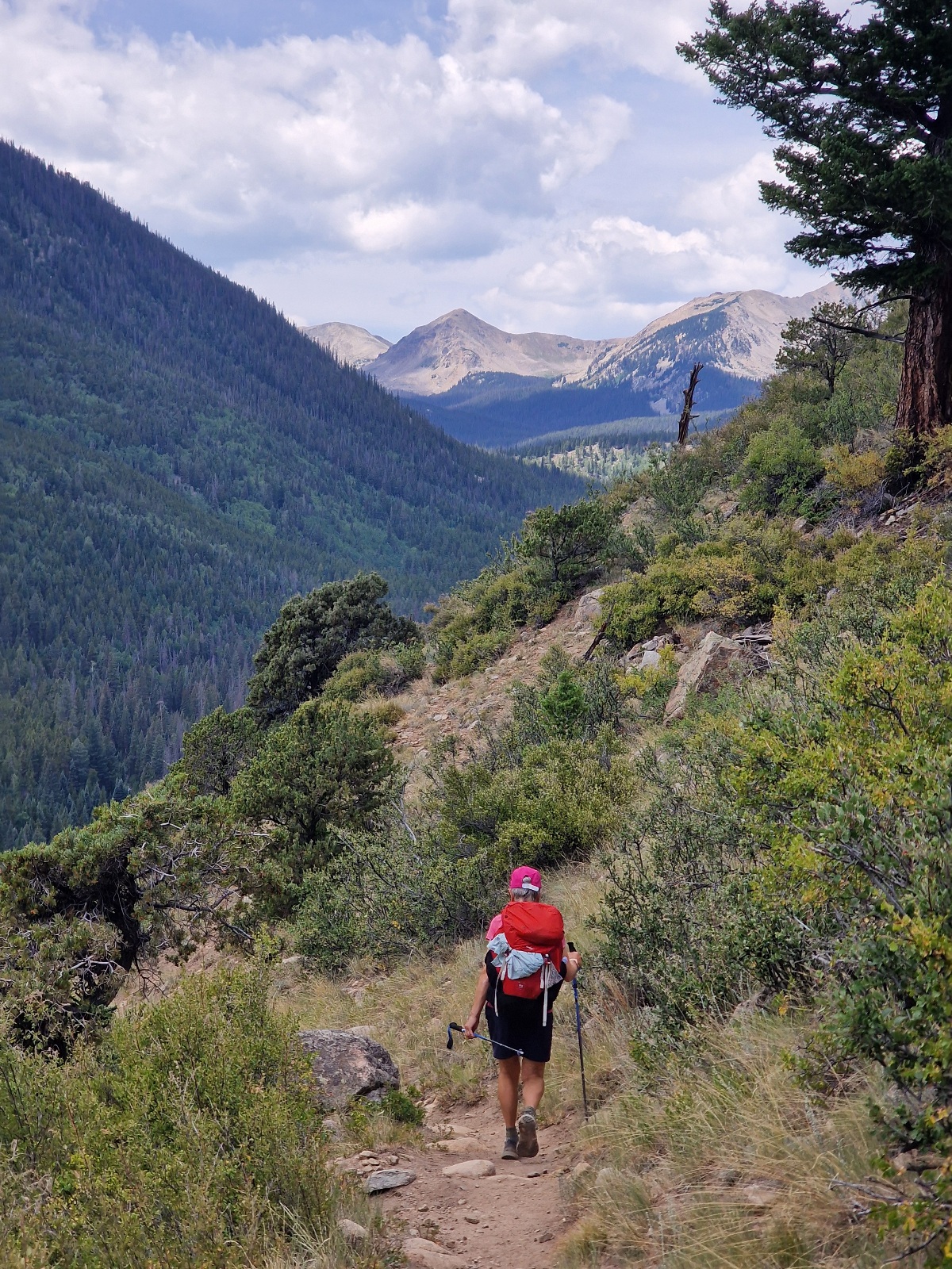
We started hiking at 7 a.m. The trail climbed from the first step, gaining 450 meters (1,476 ft) before it leveled out and eventually began to descend. We had a lot of climbing yesterday, and today would be no different. We made sure to go very slowly uphill to save energy. I kept an eye on my heart rate to make sure it didn’t go above 112.
Once at the top, we took a break and ate something before continuing. The trail was now a gentle downhill. Even after eating, I felt like my body was lacking energy. We went on autopilot until we reached North Cottonwood Creek after 19 km (about 11.8 miles).

We took a long break here because a big climb was waiting for us. To ensure we had enough energy, we ate our dinner here. I had a dehydrated meal from the brand Peak, which contains 1,040 calories. Most other brands have between 450 and 700 calories, which is far too little for a hike like this. It’s a shame we can’t buy Peak in Europe. We’ve considered bringing a plastic bottle of olive oil to add to our dinners for more calories, but we didn’t do it this time.


Ahead of us was an 800-meter (2,625 ft) climb. I prefer to do long climbs like this first thing in the morning, not in the afternoon when temperatures are at their highest and our bodies are a bit tired. We had already hiked 19 km (about 11.8 miles).
I saw on the FarOut app that there was water and a possible campsite after 550 meters (1,804 ft) of climbing. That became our primary goal.
The climb was steep—in fact, the steepest we’ve had on this trip. When hiking as a couple, both people should be working at a similar level on the climbs. I’m stronger than Inger, so we put her heavy items in my pack. My pack then weighs 3–4 times as much as hers, which makes the climb almost equally difficult for both of us. As usual, we maintained a slow, steady pace. If we have to stop to catch our breath, we’re going too fast. In this thin air, above 3,000 meters (10,000 ft), breathing becomes rapid. It’s better to take an extra half hour on the climb than to wear ourselves out.

The trail followed the right side of a river valley as it went up. After a good 500 meters (1,640 ft) of climbing, we reached a point where the river valley widened and flattened out. We found a place to camp there. We were tired, but not exhausted. We found a spot among a group of pine trees, about 8 meters (26 ft) above the valley floor. I hoped we would avoid condensation there and that the cold air would stay below us during the night. The temperature in the afternoon was 22°C (72°F).
We saw horse manure on the trail again today. We met a couple riding down the trail. At first glance, they looked like horses, but they were likely mules.

Today’s stage was 23.5 km (about 14.6 miles) with 1,150 meters (3,773 ft) of elevation gain.
We are now camping at 3,380 meters (11,089 ft).
