The Colorado Trail, Day 26. Sunday, August 24, 2025.
We spent the night at the Hangout Hostel in Lake City. Eight of us hikers had booked a ride back to the trail for 7:00 a.m. We got up while it was still dark.
At 6:45 a.m., seven of us hikers walked to meet the car. I thought there were supposed to be eight of us. It was just after sunrise, but for the first time in a long time, it was cloudy in the morning. Not the best sign; rain and thunderstorms were in the forecast for later in the day.
The car came to meet us, and we saw that Chuck, whom we hadn’t seen since Twin Lake, was in the passenger seat. He had stayed at the RV park. The car was a pickup with space for five passengers inside. Three of us had to sit in the open bed in the back.
The driver helped us load our packs. When he lifted Inger’s pack, he said, «Wow, this one is light. Are you sure you have everything?»
We all laughed. Before we left the hostel, everyone had felt my pack. They knew I was carrying all the food and shared gear.

It was about 30 km (18.6 miles) and a lot of elevation gain up to the trail. As we drove, we saw many deer along the road.
At 7:30 a.m., we were on the trail.
Inger and I, Chuck, a Spanish guy whose name I don’t remember, the young women Marissa, Diana, and Maddison, and Rouky, who, at 77, was the oldest of the group.
The temperature was 9 °C (48 °F), but it felt colder. There was no sun to warm us up.

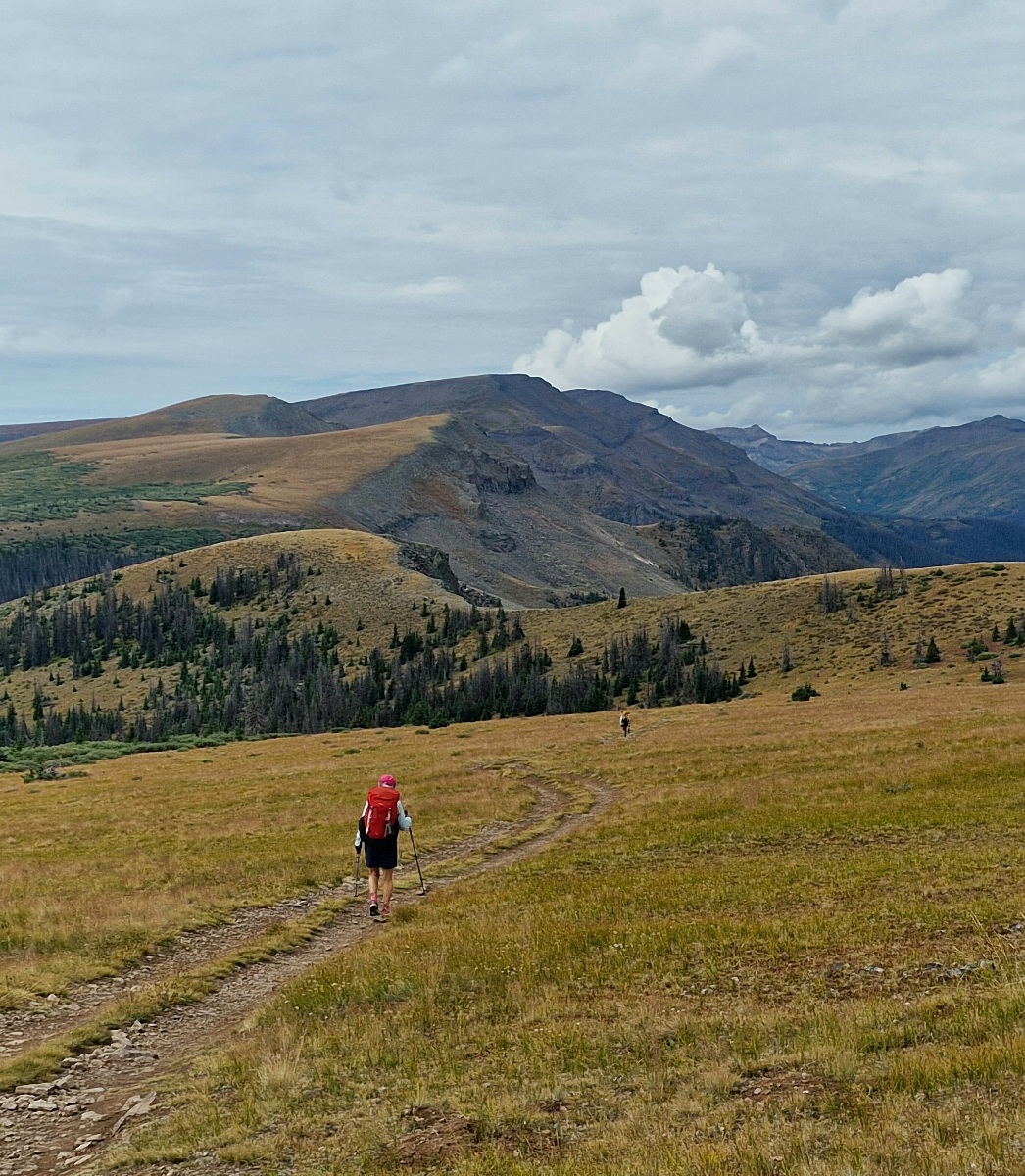
The trail had a slight incline from the start, and after 6 km (3.7 miles), we reached the Jarosa Mesa plateau. The plateau was almost flat, but the ground was stony and difficult to hike on.

We had a few small stops along the way—nature calls—and we also changed our clothing.
Chuck, Marissa, Maddison, and the Spanish guy eventually formed a group in front. Inger, Diana, and I followed, and Rouky was a long way behind us.


We all pretty much had the same primary goal: a flat area at the treeline where it was possible to set up our tents. It was only 15 km (9.3 miles) to get there. If we went any farther, we would go above the treeline and up to the highest point on the CT, 4,041 meters (13,258 feet) above sea level. With the weather that was forecast, we didn’t want to continue.
After 14 km (8.7 miles), we would come to a stream. No one had stopped for a food break, and I figured the group in front would stop there to eat and fill up their water.
Where the FarOut app marked the stream, there was no water, but comments in the app explained that you had to continue a few hundred meters into the forest to find the stream.
That was correct, and we met the four people in front there. I asked them if they were going to stop after 15 km or continue. Everyone except the Spanish guy was going to stop. They had recently checked the weather forecast. We also decided to stop there.
When I was done filling and filtering my water, I had 5.5 liters (1.45 gallons) of water. It would be 16 km (9.9 miles) to the next water source.
Then we walked the last kilometer (0.6 miles) up to the plateau, where we set up our tents. Fortunately, there were many good campsites there.
About an hour after us, Rouky arrived. He was furious; he hadn’t found the stream and only had half a liter of water left. Chuck explained how to find the stream and offered to go with him back to it. Rouky thanked him but declined the offer. He figured he would find the stream now, which he did.


It wasn’t even noon yet when we had set up our tents, and it was a long afternoon while we wondered when the rain would come. We saw dark clouds, and after a few hours, the rain and eventually the thunderstorm came, which fortunately passed to the north of us.
At 6:00 p.m., it was all over, but it was still cloudy and 8 °C (46 °F). We’re prepared for a cold night, perhaps with temperatures below freezing.
The plan is to start at sunrise tomorrow. There is no rain in the forecast until the middle of the day. By then, we’ll have passed the very highest section.
An hour before sunset, we heard coyotes in the distance.
Today’s hike was 15 km (9.3 miles) with an elevation gain of 645 meters (2,116 feet).
We are tenting at 3,670 meters (12,040 feet) above sea level.