The Colorado Trail, Day 28. Tuesday, August 26, 2025.
We tented at 3,843 meters (12,608 feet), and it was clear during the first part of the night before it clouded over. A few drops of rain actually fell during the night. The cloud cover meant that the morning wasn’t as cold as we had feared at this altitude, at 3 °C (37 °F).
As usual, we get up at 5:30 a.m., a little over an hour before sunrise, and it will still be dark until after 6:00 a.m. While we were eating breakfast by the light of our headlamps, we heard a lone coyote howl not far from us. It kept going for a long time but got no response from others. Usually, we hear several.
At 6:30 a.m., we were hiking. Chuck started right after us. It was completely overcast with fog hanging in the high elevations. Rain was in the forecast for early morning, and we had our rain gear ready at the top of our packs. The temperature only rose to 8 °C (46 °F), and we were wearing plenty of clothes, including gloves.

The trail went up and down across the landscape, all of it above the treeline. The highest point was 3,962 meters (12,998 feet) above sea level. The fog came and went. We would suddenly be enveloped in fog, only to just as suddenly come out of it. Fortunately, there was only a light wind.


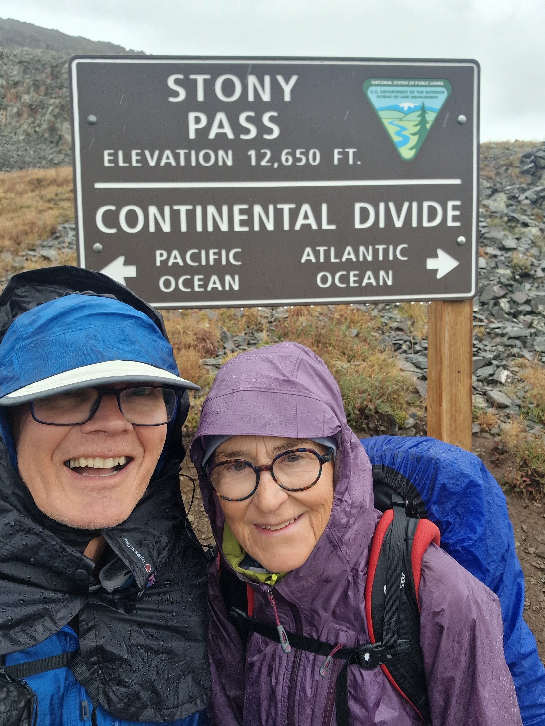
We were hiking westward, and to the south, we could see that it was raining. We were prepared for it to reach us, but we were still a little caught off guard when the first drops came down.


Would it be a lot? Should we put on our rain gear now? The rain is often short-lived. We chose to put it on. Now we saw that it was really gray, and we also put on our rain pants. That was a good thing because it turned into a real downpour.
It rained the entire time as we put kilometers behind us. When we got to Stony Pass, 3,839 meters (12,595 feet) above sea level, after 11 km (6.8 miles), there was a short break.
Was it a warning or a sign? Now we had a choice to make.
The section we are on now goes between the highways leading to Lake City and Silverton. We planned to reach the highway to Silverton tomorrow afternoon. Inger couldn’t keep warm and was freezing in her wet gloves. The temperature was 8 °C.
From Stony Pass, it was possible to follow an old, original horse and carriage road from 1872 into Silverton. The road, which is passable with off-road vehicles, goes down 1,000 meters (3,281 feet) into the valley to the north and then continues to Silverton, a distance of 17 km (10.6 miles).
Thunderstorms and rain were in the forecast for the rest of the day. Inger was so cold and insisted on leaving the trail and walking down into the valley to the north. We said goodbye to Chuck, who continued on the trail, and followed the bumpy and rocky dirt road down from Stony Pass.

300 meters (984 feet) down into the valley, we stopped to eat; there was a break in the rain. As we were packing up our bags and getting ready to continue, the rain started again. It rained until we had descended 1,000 meters and reached the valley floor.


The valley was really beautiful: wild and dramatic with steep, high alpine mountains. On the valley floor and up along the lower parts of the valley sides, we saw remnants of mining operations.

The cloud cover lifted over the valley, and we took a break while we took off and dried our rain gear. We continued down the almost horizontal valley until it opened into the valley that leads to Silverton.
We had now walked 21 km (13 miles) and had 7 km (4.3 miles) left to Silverton.
Suddenly, a car came up behind us on the road. The road was bad, so it was driving slowly. I put out my thumb while still walking, and the car actually stopped. It was an elderly couple, George and Joan, who were on their way home to Durango. They had a cabin up in the valley.
The couple dropped us off in the charming little town of Silverton, with about 650 inhabitants. The town was originally a mining town but is now dominated by tourism. All mining has now ceased. A tourist train with a steam locomotive runs daily between Durango and Silverton. On our road trip last year, we were actually in Silverton, so the town and its history were not new to us.
It was barely 1:00 p.m., but we were able to check directly into the Triangle Motel. While Inger was showering, I dried the tent on the sidewalk outside. As I was doing this, I saw a woman walking with two shopping bags. When she came up to me, she said, «Isn’t that Three Dinners?» which is my trail name. It was Vida, whom we had met 20 days ago. She came into town yesterday and is going back out again tomorrow.
On our way out to dinner, after showering and getting ready, we met two younger men on the street. «Aren’t you the Norwegian?» one of them said. They were two cyclists we met on the trail yesterday. They had gotten very wet and were now on their way to buy rain gear. We meet a lot of people on our hike.


Late in the afternoon, the storm hit Silverton. We noticed that the wind started to blow hard. We looked out—oh, really dark clouds. Then the sky opened up, and it was practically pouring, accompanied by rumbles of thunder. It went on for a couple of hours, and we were very happy to be indoors.
Tomorrow, we’ll be back on the trail. We now have five days of hiking left until we reach Durango, which is the end of the CT.
Today’s hike was 21 km (13 miles) with an elevation gain of 550 meters (1,804 feet). We are spending the night at a motel in Silverton, 2,835 meters (9,301 feet) above sea level.