Colorado Trail Day 23.
Thursday, August 21, 2025.
When we started our hike on the CT three weeks ago, sunrise was at 6 a.m. We’ve now been hiking south and west, and in these three weeks, the sunrise has gotten 30 minutes later.
As we were packing up the tent today at 6:35 a.m., we saw the bright red sun rise above the horizon. The family of deer we saw yesterday was still hanging around the campsite this morning. Five minutes later, we were on our way.
The trees, which the sun shone on, got a reddish color for the first 10 minutes until the sun got higher above the horizon. Yesterday, our hands got really cold at the start of the hike, so we wore gloves today. The temperature was just above freezing, at 1°C (34°F).


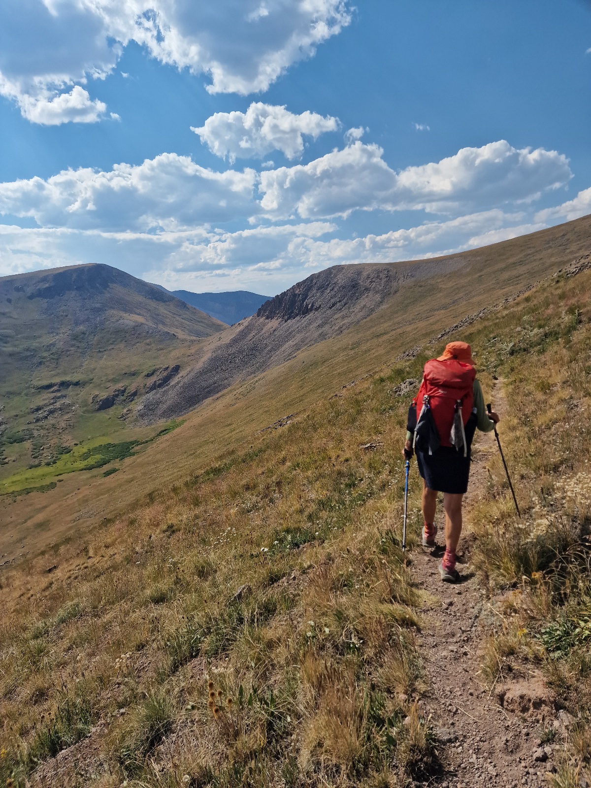
We’ve been looking forward to this part of the CT we are now starting. There has been a surprising amount of forest hiking in the three weeks we have been on the trail so far. Over the next 5-6 days, we will mostly be hiking above the tree line, giving us fantastic views, according to what others say. We just hope the weather holds up.
The first part of today’s hike was a climb of over 300 vertical meters (984 feet) up to the pass, 3,846 m (12,618 ft.) above sea level, south of San Luis Peak. It had only been a little over an hour since sunrise when we got up there, and we came into the shade as we went down the other side. The guidebook described the section we are hiking today as a roller coaster, up and down and up again.


We dipped down a few hundred vertical meters, then up to the next pass, then down again, and back up. After 11 km (6.8 miles), we reached the highest pass of the day at 3,925 m (12,877 ft.). Luckily, there was a little wind on the climbs, so it didn’t get too hot, as the sun was blazing the whole time. As usual, we made sure to maintain a calm and steady pace on the climbs. There would be a lot of vertical gain throughout the day.


We had three more climbs to passes before those were behind us and we started to go downhill. We could then see what we had set as our goal for the day 3-4 km (1.8-2.5 miles) in front of and below us. It was a lake where there should be a possibility to camp, but it was still above the tree line.


The lake is on Snow Mesa, a large plateau with steep edges down into a canyon to the south. We reached the lake after just under 25 km (15.5 miles) of hiking. It was blowing quite hard, and there were no good tent spots there. We chose to continue hiking.

In a stream we passed shortly after, I filled up so that we had about four liters (1 gallon) of water.
The plateau was several kilometers long. About 8 km (5 miles) after we passed the lake, the trail would cross Highway 149 at Spring Creek Pass. Inger was determined that this would now be our goal for the day, and we picked up the pace.
From the end of the plateau, 2.5 km (1.5 miles) from Spring Creek Pass, the trail went steeply downhill for over 400 vertical meters (1,312 feet). The surface was the worst kind: small stones, large stones, and loose gravel. Inger has never, in recent years, gone down such a steep hill at the speed she had this afternoon. Our shoe treads are starting to wear down, and we slid several times, but luckily without falling.

It was seven o’clock when we got down to the highway. There was a trailhead there, a parking lot, and an area with benches and tables for day visitors. Camping was not allowed. It was getting dark soon; we weren’t camping, just tenting for the night, so we set up the tent on the edge of the area.
At the parking lot, we counted six deer when we arrived. They stayed in the area overnight, as I heard some walking not far from the tent during the night.
It was a long and tiring day with a lot of vertical gain, but also the day we’ve had the best view so far.
Today’s hike was 32 km (20 miles) and 1,520 vertical meters (4,987 feet). We are camping at 3,325 m (10,909 ft.) above sea level.