GR131 Canary Islands, Day 12, Saturday, January 24, 2026
Finally, we’re ready to start the hike across Gran Canaria. I’ve been looking forward to this section; proper mountain terrain and hopefully not too much wind. The forecast looks promising. It has been raining in the mountains here for the past few days, but no precipitation is expected for the coming days. Excellent—and I have to admit, a bit of luck.
We arrived from Fuerteventura two days ago and had a rest day yesterday. It wasn’t that we actually needed one, but I had promised Inger. Personally, I’m not a fan of rest days unless our bodies are truly exhausted, which wasn’t the case for us. You lose that «hiking bubble» you’re in, and it makes it a bit harder to get started again. Rest days are overrated.
We had rented a bungalow in Maspalomas and were on the trail by 8:30 AM. We followed the route that goes up along the riverbed that runs through all of Maspalomas. The riverbed is completely dry right now.
You’d think your body would feel fresh after a rest day, but that wasn’t the case for us. My pack felt extra heavy—which makes sense when you’re carrying nearly eight days’ worth of food rations. As usual, I’m the one carrying all the food. In addition to our standard trail meals, we had packed some leftovers we hadn’t finished at the bungalow.

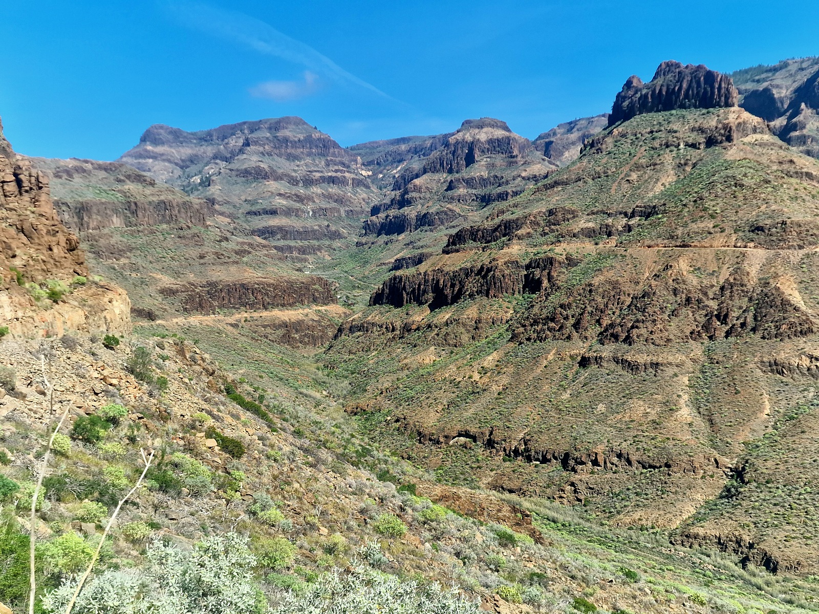
After passing under the bridge on the GC-1, the official route turns left and follows the GC-503 up the valley to Ayagaures. Walking 14 km (8.7 miles) on a narrow paved road with car traffic didn’t appeal to us, so we chose to follow a valley located «two valleys» to the right, east of the GC-503.

There is a UTV track up this valley, and the terrain was rocky and occasionally heavy going. The path followed the gentle valley floor upward. This was undoubtedly a tougher route, but we avoided the asphalt and the cars. Here, we were at one with nature, even though we did encounter three UTVs on a safari heading down the valley.


7 km (4.3 miles) up the valley, after 12.5 km (7.8 miles) of hiking, the trail left the valley floor and wound its way 200 meters (656 feet) up the west side of the valley until it hit the narrow gravel road, GC-602.


We followed GC-602 for 3 km (1.9 miles) and 170 meters (558 feet) of descent down to Ayagaures.


In Ayagaures, there is one restaurant and one bar/restaurant. We chose the closest one, Bar Pilancones. In addition to drinks, I ordered a fish dish while Inger went with the chicken. The meals were simple, but they tasted great. We had a nice hour-long break outside the bar before continuing our hike.

From Ayagaures, the route continued for 1 km (0.6 miles) up the west side of the valley, crossed the valley over a dam, and then continued up the east side. The road ended shortly after, and from there, it was all trail hiking.


Eventually, we entered a sparse pine forest. The views kept getting better as the route climbed the valley side. We followed the path for just under 5 km (3.1 miles) and 620 meters (2,034 feet) of elevation gain from the dam until we found a good spot to pitch the tent.
It was 5:00 PM by then. We are camping at 960 meters (3,150 feet) above sea level.


Today’s hike was wonderful. The weather was brilliant with sun and temperatures in the 20s°C (70s°F). The light breeze that brushed past us was very welcome.
The area—the nature, the surroundings, the flora, and the mountains—reminded us of parts of Arizona and Southern California where we’ve hiked and felt right at home.
We hope tomorrow will be just as great as today. The forecast predicts 4°C (39°F) and fog tonight until sunrise, followed by sun for the rest of the day.
Today’s stats: 23 km (14.3 miles) and 1,109 meters (3,638 feet) of elevation gain.