Sørøya Day 1: Wednesday, July 9, 2025
Earlier this year, I was on Sørøya, or South Island, in New Zealand, hiking its length. Now, I find myself on a different Sørøy, on the complete opposite side of the globe from New Zealand: Sørøya in Finnmark, Norway. Here too, a hiking route has been established along the island’s length, and I’m about to hike it with Inger.
For those who don’t know, Sørøya is located west of Hammerfest. It’s Norway’s fourth-largest island and the largest island without a mainland connection. Approximately 1,100 people live on the island, mainly in the southwest. There are a few kilometers of paved public roads in the far southwest of the island, in the Hasvik municipality. Otherwise, it’s largely car-free – perfect for hiking!
Four years ago, a nearly 100 km (approx. 62 miles) hiking route was established between Tarhalsen in the north and Fuglen in the southwest of the island. The route is marked and signposted, but there are no overnight cabins. There are plans to build cabins for accommodation. For now, you have to use a tent, which is no problem for us, as we’re accustomed to hiking with tent overnight stays.
DNT (the Norwegian Trekking Association) is organizing an 8-day «Sørøya lengthwise» hiking trip later in July. We plan to complete it in 5 days. Additionally, we’ll spend one day hiking back from Tarhalsen to Hellefjord.
To reach Sørøya, you can fly to Hasvik, take a ferry to Hasvik from Øksfjord, or a express boat from Hammerfest. We chose the latter, as I have children and grandchildren in Hammerfest.

At 7 AM today, we took the express boat from Hammerfest to Hasvik. Two hours and fifteen minutes later, after stopping at a few fjords with sparse populations, we arrived in Hasvik. From here, a 32 km (approx. 20 miles) road leads to Sørvær, our destination. There’s a bus going there in about 9 hours.
A ferry from Øksfjord was arriving in about 15 minutes, so we decided to try and hitch a ride with one of the cars. Surely some would be heading to Sørvær.
The very last car off the ferry stopped and picked us up! It was Astrid, who was going to her cabin in Breivik, about 8-9 km (5-6 miles) before Sørvær. She needed to mow the lawn at her cabin and offered to drive us to Sørvær if we hadn’t found another ride by then. There was very little traffic on the road. We went with her to the cabin, I mowed the lawn, and then she drove us to Sørvær.
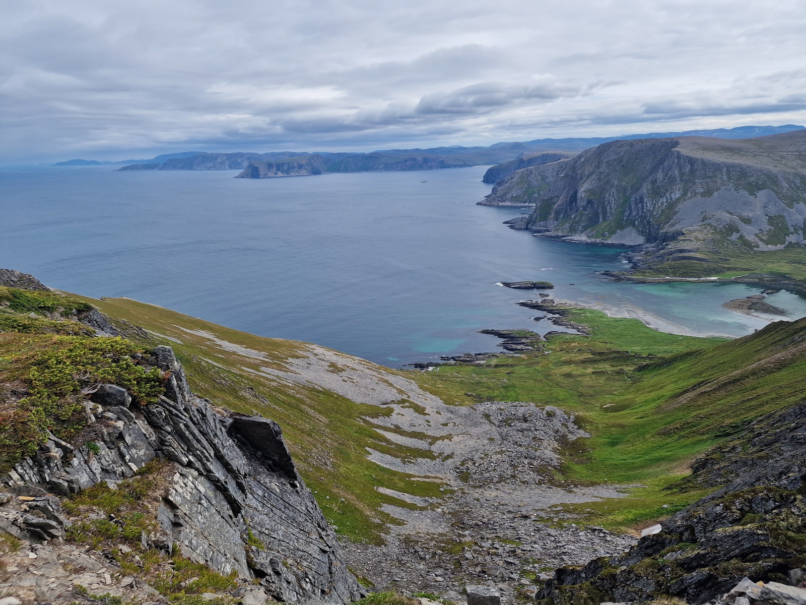
From Sørvær, it’s four kilometers (2.5 miles) to the endpoint at the cliff edge north of Fuglen. A closed gravel road leads to the military station on Fuglen, and the trailhead is half a kilometer further on a trail towards the 320-meter (approx. 1,050-foot) high cliff edge.
It was past noon when we set off up the very steep gravel road to the plateau where Fuglen, at 374 meters (approx. 1,227 feet), is located. A strong wind was blowing from the southeast on the plateau, but surprisingly, right at the trailhead, where there was a cairn and a sign, it was completely calm.


After the obligatory photos and admiring the view, we set off towards the northern end of the island. The outer side of the island, facing the Arctic Ocean, consists of steep cliffs, broken up by some wide, deep fjords. The route we’re hiking follows the ridges in the middle of the elongated island.

After hiking back down the gravel road, we were back on a proper trail. The temperature was 13 degrees Celsius (55 degrees Fahrenheit) – not bad out here on the exposed coast. The wind wasn’t as strong now, and we could sometimes walk in long-sleeved shirts. At the start of our hike, we twice met two other hikers who were on their last day of hiking Sørøya lengthwise.

The terrain was easy to walk, and the views were fantastic. Far to the south, in the distance on the mainland, we could see the white glacier, Øksfjordjøkulen, Scandinavia’s 10th largest glacier.

The forecast predicted no precipitation for the next few days, but we could see some rain showers moving around us. Just before we were about to set up camp, one of these showers hit us. Fortunately, it wasn’t much rain, but it’s still annoying to set up camp in the rain.


There were many birds to see and hear during the hike. After we had pitched our tent, we were attacked by a pair who likely had young in the area. Fortunately, everyone was fine.


Today’s hike covered a total of 21 km (13 miles) and 1,150 meters (3,773 feet) of elevation gain.