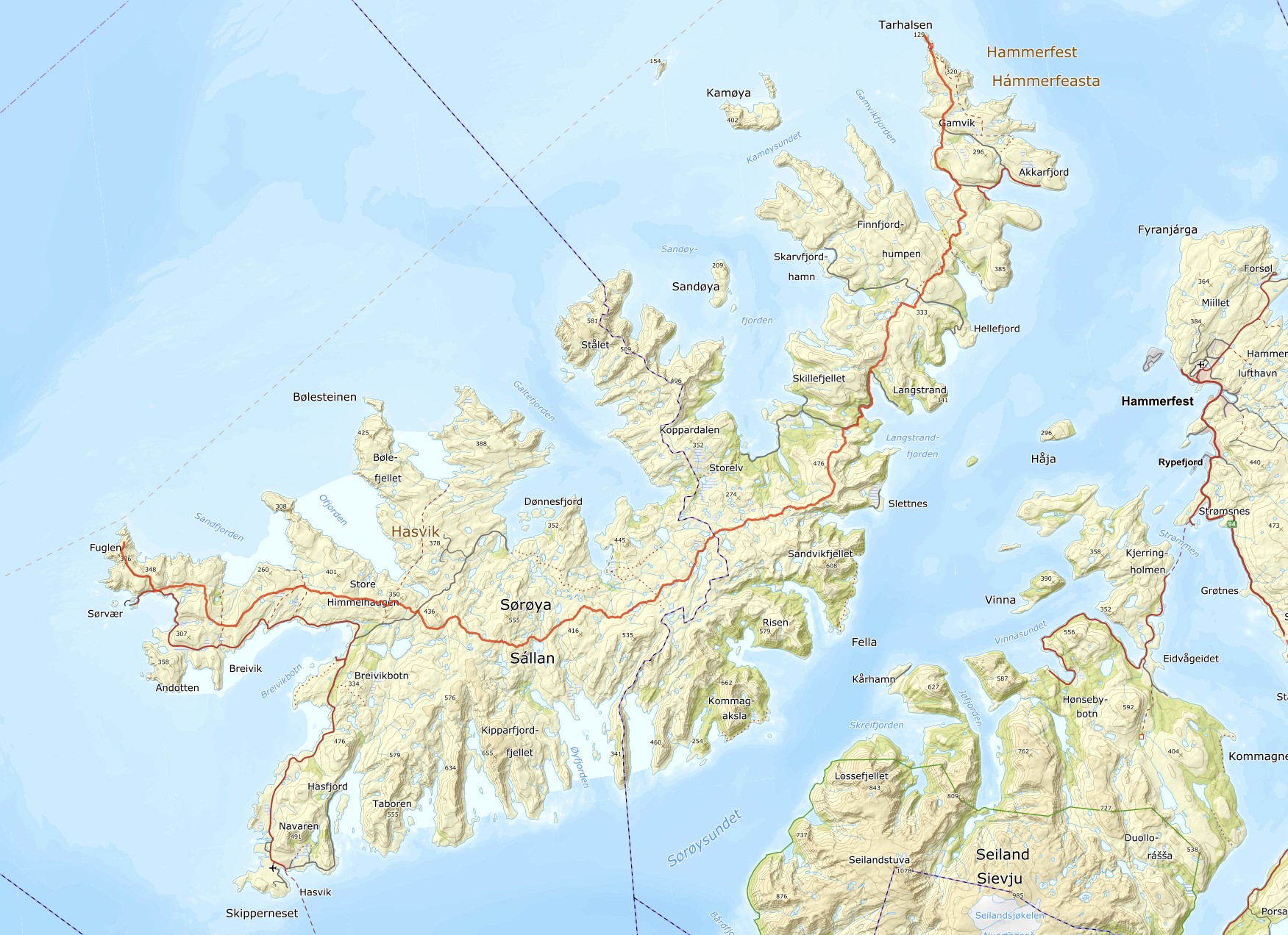
Sørøya (or Sørøy Island) is located in Finnmark, at the very northern tip of Norway and Europe, 350 kilometers (about 217 miles) north of the Arctic Circle.
A 95-kilometer (about 59-mile) hiking route stretches across the entire island, from Fuglen in the southwest to Tarhalsen in the north.
Sørøya sits at 70.4 degrees North latitude and is Norway’s fourth-largest island. Despite its size, only about 1,000 people live there, with the majority residing in the southwest. The island lies right on the edge of the Arctic Ocean and features dramatic cliff landscapes to the north.
Hikers can choose to travel northbound from Fuglen or southbound from Tarhalsen. We opted to hike northbound, starting on July 9, 2025, and completing the trek in five days.
To reach the southern end of Sørøya, you can take an express boat from Hammerfest or a ferry from Øksfjord. Both arrive at the small settlement of Hasvik, which has a pier. From Hasvik, you can either take a bus to Sørvær, or, like us, hitch a ride with one of the few cars that travel between the two locations. The distance is 36 kilometers (about 22 miles). From Sørvær, it’s a four-kilometer (2.5-mile) walk to the cliff edge at Fuglen.
Tarhalsen in the north can be reached via an express boat from Hammerfest, which calls at Akkarfjord. From Akkarfjord, it’s about 12 kilometers (7.5 miles) to Tarhalsen. Five of these kilometers are on a gravel road where it’s possible to arrange transport.
As of 2025, there are no public cabins for overnight stays along the main hiking route. However, there is an open private shelter north of Mattisvannet lake and a municipal day-use cabin, Gamvikvannhytta, where overnight stays are possible. This hut is located right by the gravel road at Gamvikvannet, two kilometers east of the route near Gamvik. At Tarhalsen, right by the northern endpoint, is the DNT cabin Tarhalshytta, offering three beds.
Map over sørøya with gpx-track.